Funes night lights from space
Night Light of Funes (Santa Fe) from space (Argentina) Src. Average luminocity for 10x10km area is 60.2527% and for 50x50km: 24.8%.
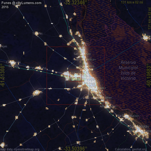
Analysis of Funes night lights 2016
Square area 10x10 km:
 10.07%
90-99
12.64%80-89
9.34%70-79
6.23%60-69
7.88%50-59
11.36%40-49
12.64%30-39
14.47%20-29
15.02%10-19
0.37%0-9
0%Square area 50x50 km:
5.71%90-99
5.05%80-89
2.03%70-79
2.62%60-69
3.1%50-59
3.26%40-49
3.77%30-39
4.07%20-29
5.98%10-19
9.81%0-9
54.6%Clear (daylight) street map image can be seen on geolist.org.
Map coordinates:
32° 19' 24.5" South, 61° 30' 47.1" West
32° 54' 56.4" South, 60° 48' 35.8" West
33° 30' 14.3" South, 60° 6' 24.6" West
Some cities around Funes sort by population:
• Rosario
16.3 km =10.1 mi,  102°
102°
• Gobernador Gálvez
20.3 km =12.6 mi,  128°
128°
• Granadero Baigorria
10.8 km =6.7 mi,  52°
52°
• Capitán Bermúdez
13.4 km =8.3 mi,  39°
39°
• Pérez
10 km =6.2 mi,  156°
156°
• Carcarañá
32.7 km =20.3 mi,  281°
281°
• Fray Luis A. Beltrán
15.8 km =9.8 mi,  28°
28°
• Roldán
9.2 km =5.7 mi, 281°
3855302 (p: 14,750)
Sources (retrieved 2019-11-25):
» Earth at Night: Flat Maps 2012, 2016