Goya night lights from space
Night Light of Goya (Corrientes) from space (Argentina) Src. Average luminocity for 10x10km area is 39.9167% and for 50x50km: 3.3269%.
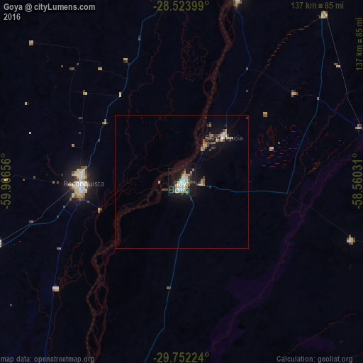
Analysis of Goya night lights 2016
Square area 10x10 km:
 7.94%
7.94%90-99
7.14%80-89
4.37%70-79
4.17%60-69
7.34%50-59
3.97%40-49
2.38%30-39
7.14%20-29
6.35%10-19
39.29%0-9
9.92%Square area 50x50 km:
0.36%90-99
0.36%80-89
0.41%70-79
0.26%60-69
0.61%50-59
0.36%40-49
0.53%30-39
0.61%20-29
0.55%10-19
3.17%0-9
92.79%Clear (daylight) street map image can be seen on geolist.org.
Map coordinates:
28° 31' 26.4" South, 59° 57' 59.6" West
29° 8' 23.8" South, 59° 15' 48.3" West
29° 45' 8.1" South, 58° 33' 37.1" West
Some cities around Goya sort by population:
• Reconquista
37.6 km =23.4 mi,  268°
268°
• Avellaneda
38.4 km =23.9 mi, 273°
• Vera
98.6 km =61.3 mi,  248°
248°
• Villa Ocampo
73.1 km =45.4 mi,  352°
352°
• Santa Lucía
23 km =14.3 mi,  42°
42°
• Las Toscas
87.5 km =54.4 mi,  0°
0°
• Malabrigo
72.3 km =44.9 mi, 251°
• Perugorría
67.2 km =41.8 mi,  109°
109°
3433715 (p: 70,245)
Sources (retrieved 2019-11-25):
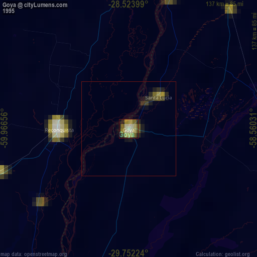
» NASA, Earths city lights 1995
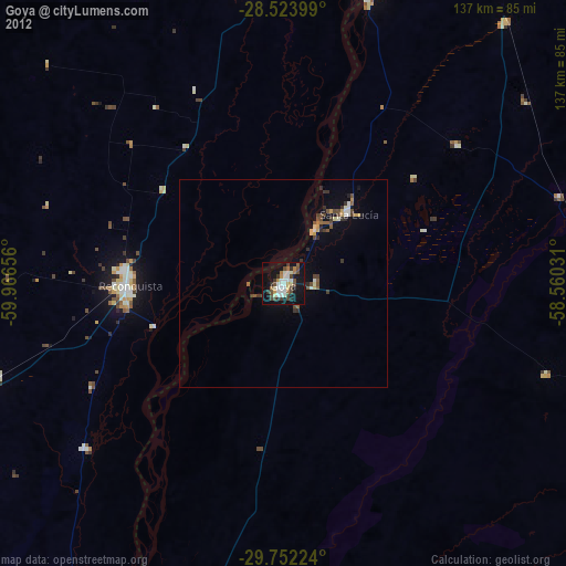
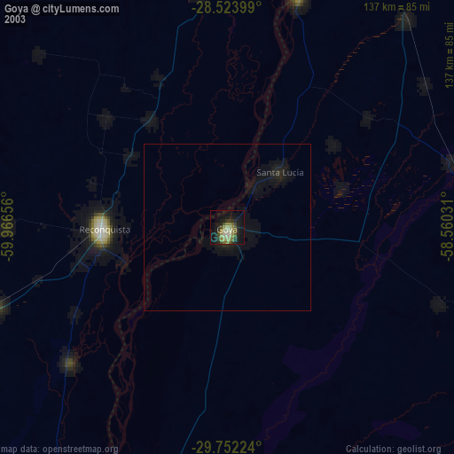
» NASA city lights 2003
» Earth at Night: Flat Maps 2012, 2016