El Soberbio night lights from space
Night Light of El Soberbio (Misiones) from space (Argentina) Src. Average luminocity for 10x10km area is 4.0227% and for 50x50km: 0.8531%.
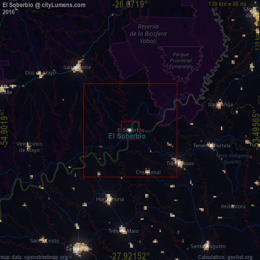
Analysis of El Soberbio night lights 2016
Square area 10x10 km:
 0.38%
0.38%90-99
0.38%80-89
1.52%70-79
0%60-69
0.95%50-59
0.57%40-49
0.19%30-39
1.33%20-29
0%10-19
0.19%0-9
94.51%Square area 50x50 km:
0.02%90-99
0.05%80-89
0.15%70-79
0.08%60-69
0.32%50-59
0.08%40-49
0.14%30-39
0.18%20-29
0.16%10-19
0.17%0-9
98.65%Clear (daylight) street map image can be seen on geolist.org.
Map coordinates:
26° 40' 18.8" South, 54° 54' 6.8" West
27° 17' 54.5" South, 54° 11' 55.6" West
27° 55' 17.5" South, 53° 29' 44.3" West
Some cities around El Soberbio sort by population:
• Santa Rosa, BR
69.5 km =43.2 mi,  203°
203°
• Três de Maio, BR
53 km =32.9 mi,  184°
184°
• Três Passos, BR
31.6 km =19.6 mi,  123°
123°
• Dos de Mayo
57.2 km =35.5 mi,  302°
302°
• Horizontina, BR
38 km =23.6 mi, 196°
• Veinticinco de Mayo
54.5 km =33.9 mi,  260°
260°
• Colonia Aurora
37.7 km =23.4 mi,  238°
238°
• Alba Posse
56.5 km =35.1 mi, 237°
3434291 (p: 19,571)
Sources (retrieved 2019-11-25):
» Earth at Night: Flat Maps 2012, 2016