Yerevan night lights from space
Night Light of Yerevan from space (Armenia) Src. Average luminocity for 10x10km area is 75.1006% and for 50x50km: 8.4158%.
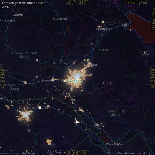
Analysis of Yerevan night lights 2016
Square area 10x10 km:
 10.71%
90-99
19.97%80-89
14.29%70-79
18.67%60-69
20.45%50-59
3.25%40-49
3.41%30-39
3.9%20-29
4.22%10-19
1.14%0-9
0%Square area 50x50 km:
0.5%90-99
0.89%80-89
1.23%70-79
1.69%60-69
2.16%50-59
0.96%40-49
1.41%30-39
1.32%20-29
2.13%10-19
4.94%0-9
82.75%Clear (daylight) street map image can be seen on geolist.org.
Map coordinates:
40° 42' 58.2" North, 43° 48' 37.8" East
40° 10' 52" North, 44° 30' 49" East
39° 38' 30.4" North, 45° 13' 0.3" East
Some cities around Yerevan sort by population:
• Vagharshapat
18.7 km =11.6 mi,  264°
264°
• Abovyan
14.5 km =9 mi,  44°
44°
• Masis
15.3 km =9.5 mi,  212°
212°
• Ashtarak
18.4 km =11.4 mi,  315°
315°
• Yeghvard
16.2 km =10.1 mi,  351°
351°
• Metsamor
22.4 km =13.9 mi,  237°
237°
• Byureghavan
16.3 km =10.1 mi,  24°
24°
• Garrni
20 km =12.4 mi,  110°
110°
616052 (p: 1,093,485)
Sources (retrieved 2019-11-25):
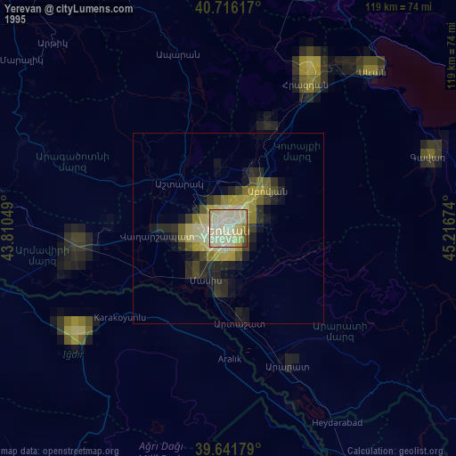
» NASA, Earths city lights 1995
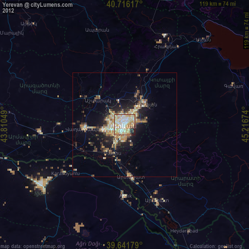
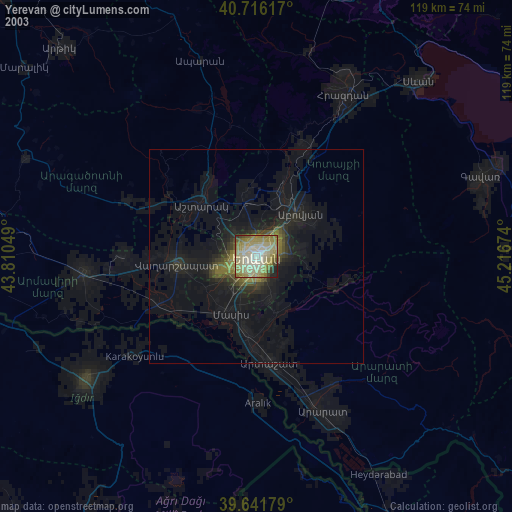
» NASA city lights 2003
» Earth at Night: Flat Maps 2012, 2016