Ashtarak night lights from space
Night Light of Ashtarak (Aragatsotn) from space (Armenia) Src. Average luminocity for 10x10km area is 0.5782% and for 50x50km: 7.9658%.
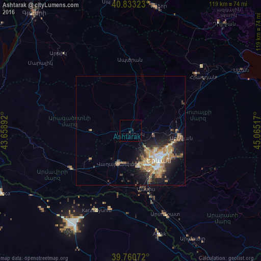
Analysis of Ashtarak night lights 2016
Square area 10x10 km:
 0%
0%90-99
0%80-89
0%70-79
0%60-69
0%50-59
0%40-49
0.68%30-39
0%20-29
0.68%10-19
0%0-9
98.64%Square area 50x50 km:
0.51%90-99
0.9%80-89
1.22%70-79
1.72%60-69
2.03%50-59
0.84%40-49
1.18%30-39
1.17%20-29
2.11%10-19
4.88%0-9
83.45%Clear (daylight) street map image can be seen on geolist.org.
Map coordinates:
40° 49' 59.6" North, 43° 39' 32.1" East
40° 17' 56.8" North, 44° 21' 43.3" East
39° 45' 38.6" North, 45° 3' 54.6" East
Some cities around Ashtarak sort by population:
• Yerevan
18.4 km =11.4 mi,  135°
135°
• Vagharshapat
15.9 km =9.9 mi,  201°
201°
• Abovyan
23.2 km =14.4 mi,  96°
96°
• Armavir
31.9 km =19.8 mi,  239°
239°
• Masis
26.4 km =16.4 mi,  169°
169°
• Yeghvard
10.9 km =6.8 mi,  74°
74°
• Metsamor
25.9 km =16.1 mi,  193°
193°
• Byureghavan
19.7 km =12.2 mi,  85°
85°
616877 (p: 18,779)
Sources (retrieved 2019-11-25):
» Earth at Night: Flat Maps 2012, 2016