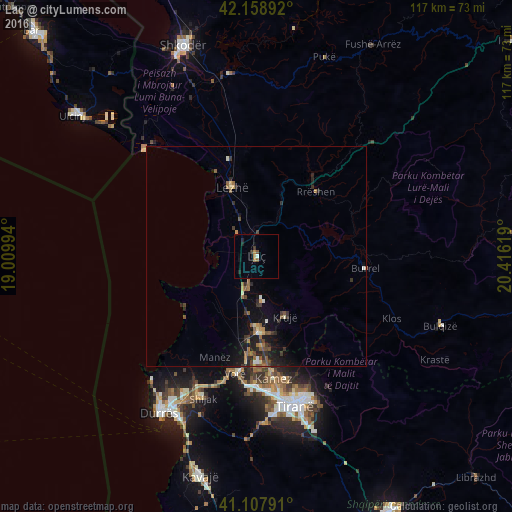
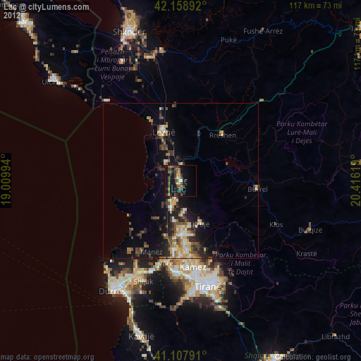
Laç night lights from space
Night Light of Laç (Lezhë) from space (Albania) Src. Average luminocity for 10x10km area is 5.0016% and for 50x50km: 2.5382%.
Analysis of Laç night lights 2016
Square area 10x10 km:
100  0.49%
0.49%
90-99 0.16%
80-89 0%
70-79 0.65%
60-69 1.3%
50-59 0.65%
40-49 0.65%
30-39 1.3%
20-29 1.46%
10-19 1.79%
0-9 91.56%
0.49%90-99
0.16%80-89
0%70-79
0.65%60-69
1.3%50-59
0.65%40-49
0.65%30-39
1.3%20-29
1.46%10-19
1.79%0-9
91.56%Square area 50x50 km:
100 0.1%
90-99 0.19%
80-89 0.21%
70-79 0.24%
60-69 0.39%
50-59 0.64%
40-49 0.34%
30-39 0.61%
20-29 0.84%
10-19 2.15%
0-9 94.28%
0.1%90-99
0.19%80-89
0.21%70-79
0.24%60-69
0.39%50-59
0.64%40-49
0.34%30-39
0.61%20-29
0.84%10-19
2.15%0-9
94.28%Clear (daylight) street map image can be seen on geolist.org.
Map coordinates:
42° 9' 32.1" North, 19° 0' 35.8" East
41° 38' 8" North, 19° 42' 47" East
41° 6' 28.5" North, 20° 24' 58.3" East
Some cities around Laç sort by population:
• Krujë
15.5 km =9.6 mi,  154°
154°
• Lezhë
17.4 km =10.8 mi,  340°
340°
• Burrel
24.7 km =15.3 mi,  96°
96°
• Shijak
34.5 km =21.4 mi,  200°
200°
• Kamëz
28.5 km =17.7 mi,  172°
172°
• Fushë-Krujë
17.5 km =10.9 mi,  178°
178°
• Rrëshen
19.9 km =12.4 mi,  42°
42°
• Mamurras
6.7 km =4.2 mi, 195°
3185012 (p: 24,825)
Sources (retrieved 2019-11-25):
» Earth at Night: Flat Maps 2012, 2016