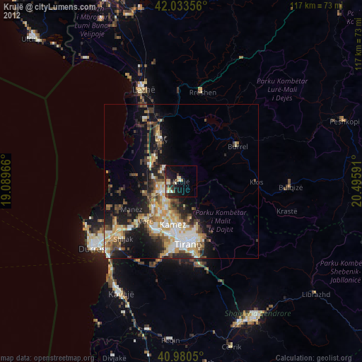
Krujë night lights from space
Night Light of Krujë (Durrës) from space (Albania) Src. Average luminocity for 10x10km area is 6.3588% and for 50x50km: 8.9232%.
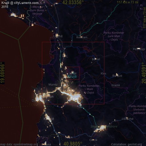
Analysis of Krujë night lights 2016
Square area 10x10 km:
100  0.51%
0.51%
90-99 0.34%
80-89 0.51%
70-79 0%
60-69 0%
50-59 1.36%
40-49 1.36%
30-39 2.89%
20-29 1.19%
10-19 5.61%
0-9 86.22%
0.51%90-99
0.34%80-89
0.51%70-79
0%60-69
0%50-59
1.36%40-49
1.36%30-39
2.89%20-29
1.19%10-19
5.61%0-9
86.22%Square area 50x50 km:
100 1.03%
90-99 1.52%
80-89 0.55%
70-79 0.99%
60-69 1.26%
50-59 1.94%
40-49 1.34%
30-39 1.64%
20-29 2.98%
10-19 5.93%
0-9 80.81%
1.03%90-99
1.52%80-89
0.55%70-79
0.99%60-69
1.26%50-59
1.94%40-49
1.34%30-39
1.64%20-29
2.98%10-19
5.93%0-9
80.81%Clear (daylight) street map image can be seen on geolist.org.
Map coordinates:
42° 2' 0.8" North, 19° 5' 22.8" East
41° 30' 33" North, 19° 47' 34" East
40° 58' 49.8" North, 20° 29' 45.3" East
Some cities around Krujë sort by population:
• Tirana
20.3 km =12.6 mi,  173°
173°
• Laç
15.5 km =9.6 mi,  334°
334°
• Burrel
21.2 km =13.2 mi,  57°
57°
• Shijak
26.2 km =16.3 mi,  225°
225°
• Kamëz
14.4 km =8.9 mi,  190°
190°
• Fushë-Krujë
7.1 km =4.4 mi,  241°
241°
• Rrëshen
29.5 km =18.3 mi,  13°
13°
• Mamurras
11.3 km =7 mi,  312°
312°
3185082 (p: 21,286)
Sources (retrieved 2019-11-25):
» Earth at Night: Flat Maps 2012, 2016