Parham night lights from space
Night Light of Parham (Saint Peter) from space (Antigua and Barbuda) Src. Average luminocity for 10x10km area is 44.9935% and for 50x50km: 6.1476%.
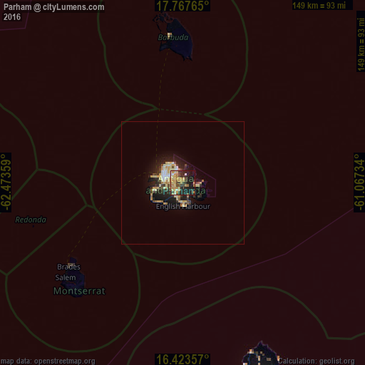
Analysis of Parham night lights 2016
Square area 10x10 km:
 0.65%
0.65%90-99
3.68%80-89
11.04%70-79
15.15%60-69
8.44%50-59
2.16%40-49
4.98%30-39
10.82%20-29
14.94%10-19
24.03%0-9
4.11%Square area 50x50 km:
0.35%90-99
0.83%80-89
1.42%70-79
1.31%60-69
0.66%50-59
0.31%40-49
0.66%30-39
1.13%20-29
2.02%10-19
4.51%0-9
86.79%Clear (daylight) street map image can be seen on geolist.org.
Map coordinates:
17° 46' 3.5" North, 62° 28' 24.9" West
17° 5' 48.6" North, 61° 46' 13.7" West
16° 25' 24.9" North, 61° 4' 2.4" West
Some cities around Parham sort by population:
• Saint John’s
8.2 km =5.1 mi,  289°
289°
• Piggotts
3.8 km =2.4 mi,  305°
305°
• Bolands
11.6 km =7.2 mi,  252°
252°
• Codrington
60 km =37.3 mi,  353°
353°
• Brades, MS
57.8 km =35.9 mi,  234°
234°
• Falmouth
7.8 km =4.8 mi,  188°
188°
• Plymouth, MS
64.1 km =39.8 mi, 227°
• Saint Peters, MS
59.6 km =37 mi, 232°
3576074 (p: 969)
Sources (retrieved 2019-11-25):
» Earth at Night: Flat Maps 2012, 2016