Chirongui night lights from space
Night Light of Chirongui from space (Mayotte) Src. Average luminocity for 10x10km area is 8.6688% and for 50x50km: 3.8186%.
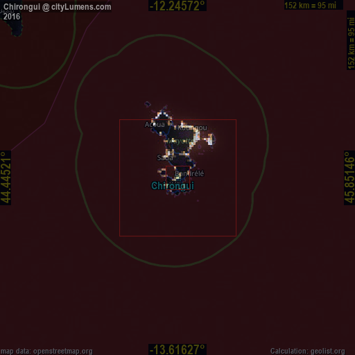
Analysis of Chirongui night lights 2016
Square area 10x10 km:
100  0%
0%
90-99 0%
80-89 0.87%
70-79 0.87%
60-69 0.87%
50-59 4.55%
40-49 1.52%
30-39 3.03%
20-29 2.6%
10-19 1.52%
0-9 84.2%
0%90-99
0%80-89
0.87%70-79
0.87%60-69
0.87%50-59
4.55%40-49
1.52%30-39
3.03%20-29
2.6%10-19
1.52%0-9
84.2%Square area 50x50 km:
100 0.38%
90-99 0.45%
80-89 0.29%
70-79 0.34%
60-69 0.51%
50-59 0.86%
40-49 0.39%
30-39 0.72%
20-29 0.52%
10-19 3.37%
0-9 92.17%
0.38%90-99
0.45%80-89
0.29%70-79
0.34%60-69
0.51%50-59
0.86%40-49
0.39%30-39
0.72%20-29
0.52%10-19
3.37%0-9
92.17%Clear (daylight) street map image can be seen on geolist.org.
Map coordinates:
12° 14' 44.6" South, 44° 26' 42.8" East
12° 55' 55" South, 45° 8' 54" East
13° 36' 58.6" South, 45° 51' 5.3" East
Some cities around Chirongui sort by population:
• Dembeni
10.6 km =6.6 mi,  21°
21°
• Sada
10.3 km =6.4 mi,  331°
331°
• Tsingoni
16.8 km =10.4 mi,  342°
342°
• Ouangani
9.6 km =6 mi,  352°
352°
• Chiconi
11.7 km =7.3 mi, 339°
• Bandrélé
5.2 km =3.2 mi,  66°
66°
• Bouéni
8.5 km =5.3 mi,  292°
292°
• Kani Kéli
5.4 km =3.4 mi,  243°
243°
1090415 (p: 6,173)
Sources (retrieved 2019-11-25):
» Earth at Night: Flat Maps 2012, 2016