Santa Teresa del Tuy night lights from space
Night Light of Santa Teresa del Tuy (Miranda) from space (Venezuela) Src. Average luminocity for 10x10km area is 45.4236% and for 50x50km: 17.8327%.
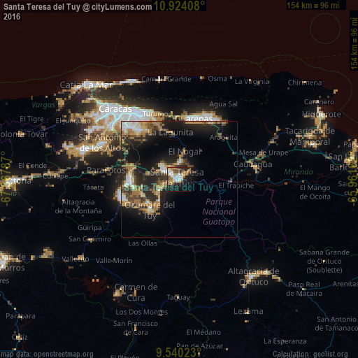
Analysis of Santa Teresa del Tuy night lights 2016
Square area 10x10 km:
 8.26%
8.26%90-99
8.47%80-89
4.96%70-79
6.2%60-69
9.71%50-59
4.34%40-49
3.72%30-39
7.44%20-29
13.43%10-19
23.76%0-9
9.71%Square area 50x50 km:
1.91%90-99
2.37%80-89
1.6%70-79
2.51%60-69
4.92%50-59
1.29%40-49
3.03%30-39
3.59%20-29
6.32%10-19
11.92%0-9
60.54%Clear (daylight) street map image can be seen on geolist.org.
Map coordinates:
10° 55' 26.7" North, 67° 22' 4.3" West
10° 13' 58.5" North, 66° 39' 53.1" West
9° 32' 24.8" North, 65° 57' 41.8" West
Some cities around Santa Teresa del Tuy sort by population:
• Guatire
30 km =18.6 mi,  26°
26°
• Cúa
25.1 km =15.6 mi,  251°
251°
• Guarenas
26.9 km =16.7 mi,  10°
10°
• Ocumare del Tuy
17.6 km =10.9 mi,  223°
223°
• Charallave
21.1 km =13.1 mi,  272°
272°
• Caucaguita
20.5 km =12.7 mi,  312°
312°
• El Hatillo
27.6 km =17.1 mi,  320°
320°
• Caucagüito
29.3 km =18.2 mi,  344°
344°
3627047 (p: 278,890)
Sources (retrieved 2019-11-25):
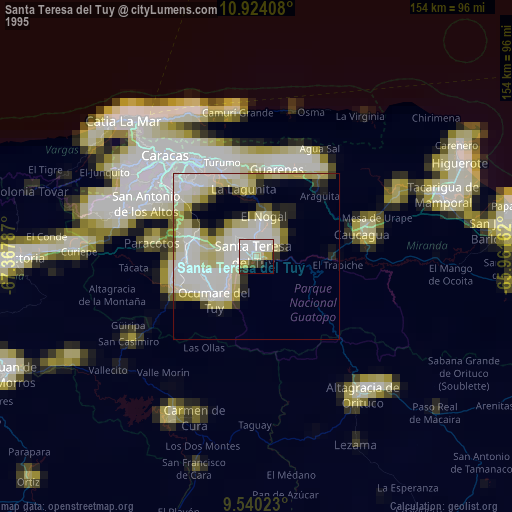
» NASA, Earths city lights 1995
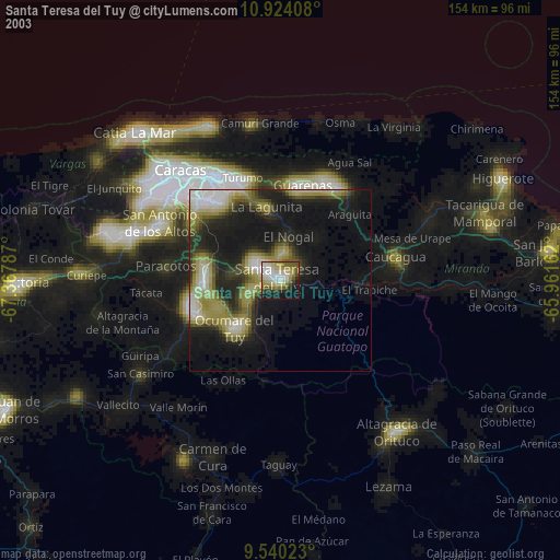
» NASA city lights 2003
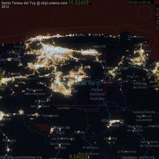
» Earth at Night: Flat Maps 2012, 2016