Charallave night lights from space
Night Light of Charallave (Miranda) from space (Venezuela) Src. Average luminocity for 10x10km area is 49.8533% and for 50x50km: 26.9061%.
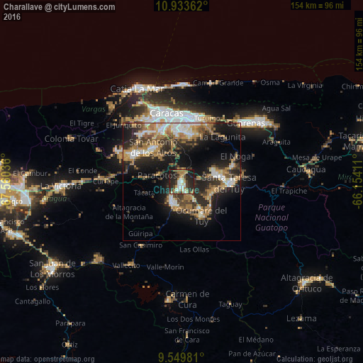
Analysis of Charallave night lights 2016
Square area 10x10 km:
 6.4%
6.4%90-99
9.3%80-89
5.37%70-79
8.68%60-69
10.95%50-59
3.93%40-49
9.3%30-39
6.4%20-29
26.45%10-19
13.22%0-9
0%Square area 50x50 km:
3.39%90-99
3.91%80-89
2.47%70-79
4.18%60-69
7.24%50-59
2.41%40-49
3.39%30-39
5.48%20-29
8.9%10-19
15.7%0-9
42.93%Clear (daylight) street map image can be seen on geolist.org.
Map coordinates:
10° 56' 1" North, 67° 33' 37.3" West
10° 14' 32.9" North, 66° 51' 26" West
9° 32' 59.3" North, 66° 9' 14.8" West
Some cities around Charallave sort by population:
• Santa Teresa del Tuy
21.1 km =13.1 mi,  92°
92°
• Baruta
21.4 km =13.3 mi,  354°
354°
• Cúa
9.3 km =5.8 mi,  197°
197°
• Ocumare del Tuy
16.5 km =10.3 mi,  146°
146°
• San Antonio de Los Altos
19.3 km =12 mi,  327°
327°
• Caucaguita
14.2 km =8.8 mi,  25°
25°
• El Hatillo
20.5 km =12.7 mi,  9°
9°
• Carrizal
18.5 km =11.5 mi,  310°
310°
3645854 (p: 129,182)
Sources (retrieved 2019-11-25):
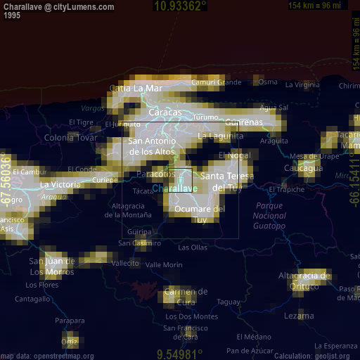
» NASA, Earths city lights 1995
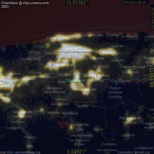
» NASA city lights 2003
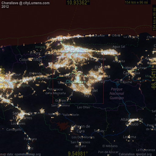
» Earth at Night: Flat Maps 2012, 2016