La Victoria night lights from space
Night Light of La Victoria (Aragua) from space (Venezuela) Src. Average luminocity for 10x10km area is 39.6446% and for 50x50km: 15.7238%.
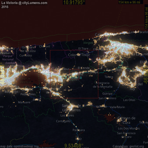
Analysis of La Victoria night lights 2016
Square area 10x10 km:
 7.64%
7.64%90-99
4.75%80-89
3.51%70-79
7.23%60-69
5.99%50-59
7.23%40-49
2.48%30-39
3.72%20-29
8.47%10-19
44.63%0-9
4.34%Square area 50x50 km:
2.13%90-99
2.21%80-89
0.82%70-79
3.05%60-69
3.24%50-59
1.81%40-49
2.26%30-39
2.51%20-29
4.8%10-19
9.86%0-9
67.32%Clear (daylight) street map image can be seen on geolist.org.
Map coordinates:
10° 55' 4.6" North, 68° 2' 3.7" West
10° 13' 36.4" North, 67° 19' 52.4" West
9° 32' 2.7" North, 66° 37' 41.2" West
Some cities around La Victoria sort by population:
• Maracay
28.5 km =17.7 mi,  271°
271°
• Turmero
15.6 km =9.7 mi, 270°
• Los Teques
34.1 km =21.2 mi,  67°
67°
• Palo Negro
23.8 km =14.8 mi,  255°
255°
• Cagua
14.7 km =9.1 mi,  252°
252°
• Villa de Cura
27.2 km =16.9 mi,  219°
219°
• San Mateo
10.2 km =6.3 mi, 261°
• Las Tejerías
17.5 km =10.9 mi,  80°
80°
3634922 (p: 87,045)
Sources (retrieved 2019-11-25):
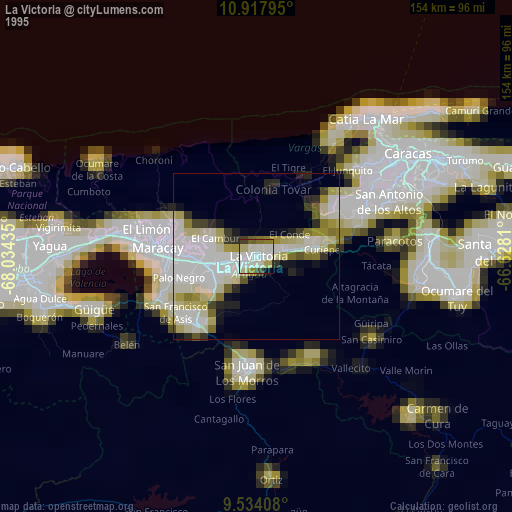
» NASA, Earths city lights 1995
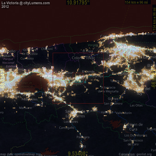
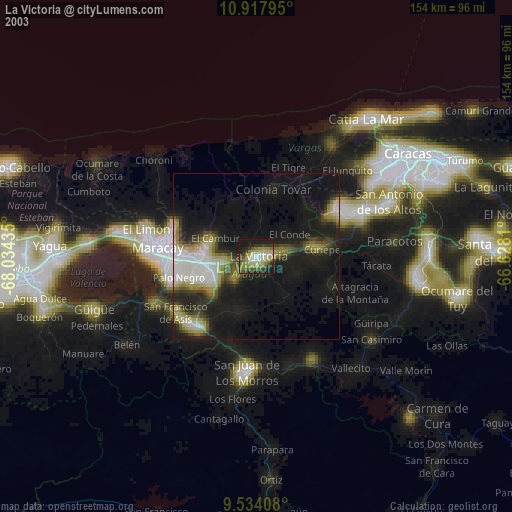
» NASA city lights 2003
» Earth at Night: Flat Maps 2012, 2016