Las Tejerías night lights from space
Night Light of Las Tejerías (Aragua) from space (Venezuela) Src. Average luminocity for 10x10km area is 16.7893% and for 50x50km: 13.3338%.
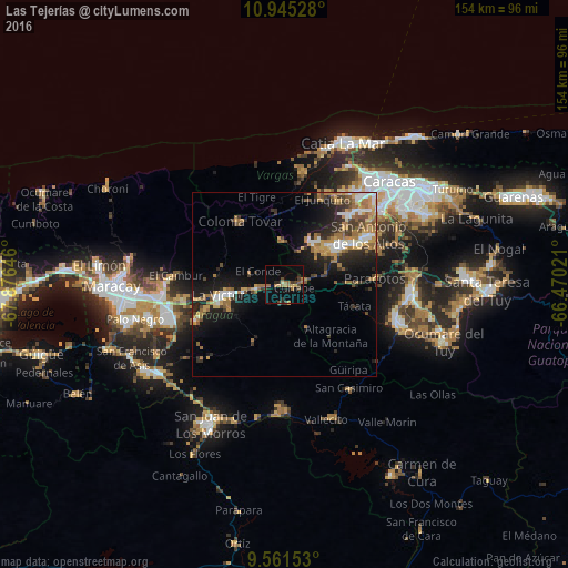
Analysis of Las Tejerías night lights 2016
Square area 10x10 km:
 0%
0%90-99
0.41%80-89
0.41%70-79
3.72%60-69
6.82%50-59
1.03%40-49
3.72%30-39
2.48%20-29
4.13%10-19
3.1%0-9
74.17%Square area 50x50 km:
1.5%90-99
1.58%80-89
0.98%70-79
2.65%60-69
3.52%50-59
1.46%40-49
1.35%30-39
2.2%20-29
3.75%10-19
8.28%0-9
72.73%Clear (daylight) street map image can be seen on geolist.org.
Map coordinates:
10° 56' 43" North, 67° 52' 35.3" West
10° 15' 15" North, 67° 10' 24" West
9° 33' 41.5" North, 66° 28' 12.8" West
Some cities around Las Tejerías sort by population:
• Turmero
33 km =20.5 mi,  265°
265°
• Cúa
33.4 km =20.8 mi,  107°
107°
• Los Teques
17.4 km =10.8 mi,  54°
54°
• Cagua
32.2 km =20 mi,  256°
256°
• La Victoria
17.5 km =10.9 mi, 260°
• San Antonio de Los Altos
28.5 km =17.7 mi,  58°
58°
• San Mateo
27.8 km =17.3 mi, 260°
• Carrizal
23.1 km =14.4 mi, 62°
3635325 (p: 33,320)
Sources (retrieved 2019-11-25):
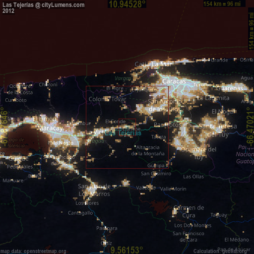
» Earth at Night: Flat Maps 2012, 2016