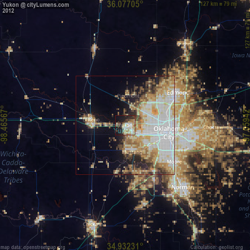
Yukon night lights from space
Night Light of Yukon (Oklahoma) from space (United States) Src. Average luminocity for 10x10km area is 51.7106% and for 50x50km: 39.1337%.
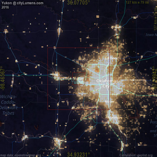
Analysis of Yukon night lights 2016
Square area 10x10 km:
 11.72%
90-99
13.37%80-89
6.59%70-79
3.48%60-69
6.59%50-59
2.2%40-49
5.68%30-39
10.99%20-29
18.13%10-19
18.5%0-9
2.75%Square area 50x50 km:
10.86%90-99
8.35%80-89
5.58%70-79
4.39%60-69
4.95%50-59
4.46%40-49
3.72%30-39
4.09%20-29
6.17%10-19
8.75%0-9
38.68%Clear (daylight) street map image can be seen on geolist.org.
Map coordinates:
36° 4' 37.4" North, 98° 27' 56.4" West
35° 30' 24.2" North, 97° 45' 45.1" West
34° 55' 56.3" North, 97° 3' 33.9" West
Some cities around Yukon sort by population:
• Oklahoma City
22.7 km =14.1 mi,  101°
101°
• Mustang
14 km =8.7 mi,  165°
165°
• Bethany
11.9 km =7.4 mi,  83°
83°
• El Reno
17.7 km =11 mi,  279°
279°
• Warr Acres
13.1 km =8.1 mi, 82°
• The Village
20 km =12.4 mi,  72°
72°
• Piedmont
15.1 km =9.4 mi,  5°
5°
• Tuttle
24.4 km =15.2 mi,  190°
190°
4556165 (p: 25,892)
Sources (retrieved 2019-11-25):
» Earth at Night: Flat Maps 2012, 2016