Williamson night lights from space
Night Light of Williamson (Arizona) from space (United States) Src. Average luminocity for 10x10km area is 0.7535% and for 50x50km: 5.5235%.
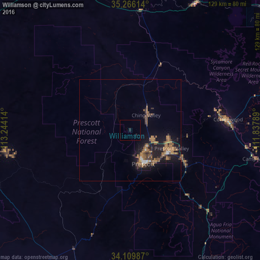
Analysis of Williamson night lights 2016
Square area 10x10 km:
 0%
0%90-99
0%80-89
0%70-79
0%60-69
0%50-59
0%40-49
0%30-39
0%20-29
1.57%10-19
0.52%0-9
97.9%Square area 50x50 km:
0.27%90-99
0.24%80-89
0.19%70-79
1.02%60-69
1.56%50-59
1.33%40-49
0.94%30-39
1.17%20-29
1.14%10-19
5.46%0-9
86.69%Clear (daylight) street map image can be seen on geolist.org.
Map coordinates:
35° 15' 58.1" North, 113° 14' 38.9" West
34° 41' 24.1" North, 112° 32' 27.6" West
34° 6' 35.5" North, 111° 50' 16.4" West
Some cities around Williamson sort by population:
• Prescott Valley
22.4 km =13.9 mi,  113°
113°
• Prescott
17.9 km =11.1 mi,  158°
158°
• Cottonwood
48.9 km =30.4 mi,  83°
83°
• Verde Village
48.5 km =30.1 mi,  87°
87°
• West Sedona
70 km =43.5 mi,  73°
73°
• Camp Verde
64.4 km =40 mi,  102°
102°
• Chino Valley
10.9 km =6.8 mi,  46°
46°
• Paulden
22.7 km =14.1 mi,  16°
16°
5321135 (p: 5,438)
Sources (retrieved 2019-11-25):
» Earth at Night: Flat Maps 2012, 2016