Westbrook night lights from space
Night Light of Westbrook (Maine) from space (United States) Src. Average luminocity for 10x10km area is 48.3667% and for 50x50km: 10.8711%.
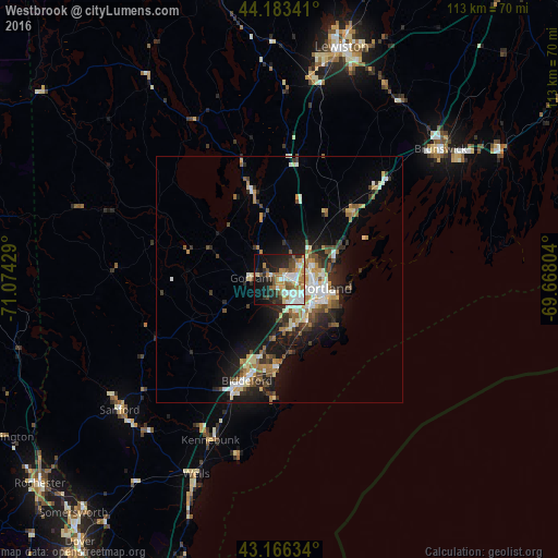
Analysis of Westbrook night lights 2016
Square area 10x10 km:
 9.24%
9.24%90-99
9.85%80-89
4.09%70-79
7.88%60-69
10.61%50-59
6.06%40-49
4.7%30-39
2.88%20-29
13.94%10-19
20.3%0-9
10.45%Square area 50x50 km:
1.31%90-99
2.04%80-89
1.36%70-79
1.2%60-69
1.65%50-59
1.35%40-49
1.56%30-39
1.3%20-29
3.15%10-19
6.72%0-9
78.35%Clear (daylight) street map image can be seen on geolist.org.
Map coordinates:
44° 11' 0.3" North, 71° 4' 27.4" West
43° 40' 37.3" North, 70° 22' 16.2" West
43° 9' 58.8" North, 69° 40' 4.9" West
Some cities around Westbrook sort by population:
• Portland
9.3 km =5.8 mi,  103°
103°
• West Scarborough
11.9 km =7.4 mi,  186°
186°
• South Portland
11.2 km =7 mi,  110°
110°
• South Portland Gardens
6.2 km =3.9 mi,  133°
133°
• Old Orchard Beach
17.8 km =11.1 mi,  181°
181°
• Buxton
12.7 km =7.9 mi,  249°
249°
• Gorham
5.9 km =3.7 mi,  272°
272°
• Yarmouth
20.2 km =12.6 mi,  47°
47°
4982753 (p: 17,978)
Sources (retrieved 2019-11-25):
» Earth at Night: Flat Maps 2012, 2016