Portland night lights from space
Night Light of Portland (Maine) from space (United States) Src. Average luminocity for 10x10km area is 61.7424% and for 50x50km: 10.7352%.
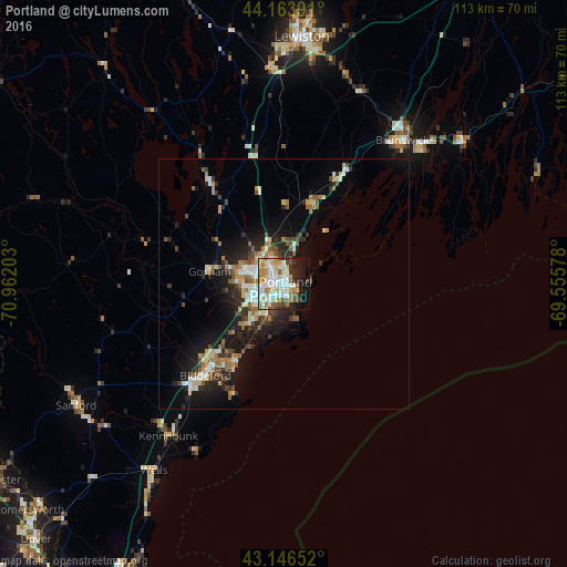

Analysis of Portland night lights 2016
Square area 10x10 km:
 12.73%
90-99
20.3%80-89
8.18%70-79
8.18%60-69
8.18%50-59
5.76%40-49
4.55%30-39
3.64%20-29
8.94%10-19
14.85%0-9
4.7%Square area 50x50 km:
1.29%90-99
1.96%80-89
1.31%70-79
1.18%60-69
1.67%50-59
1.28%40-49
1.55%30-39
1.21%20-29
3.1%10-19
7.08%0-9
78.36%Clear (daylight) street map image can be seen on geolist.org.
Map coordinates:
44° 9' 50.1" North, 70° 57' 43.3" West
43° 39' 26.5" North, 70° 15' 32" West
43° 8' 47.5" North, 69° 33' 20.8" West
Some cities around Portland sort by population:
• West Scarborough
14.2 km =8.8 mi,  227°
227°
• South Portland
2.3 km =1.4 mi,  140°
140°
• South Portland Gardens
5 km =3.1 mi,  245°
245°
• Westbrook
9.3 km =5.8 mi,  283°
283°
• Old Orchard Beach
18.3 km =11.4 mi,  211°
211°
• Buxton
21 km =13 mi,  264°
264°
• Gorham
15.1 km =9.4 mi, 279°
• Yarmouth
17 km =10.6 mi,  20°
20°
4975802 (p: 66,881)
Sources (retrieved 2019-11-25):
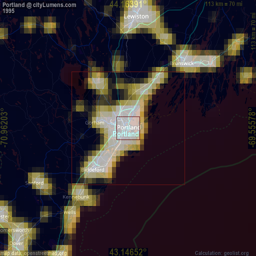
» NASA, Earths city lights 1995
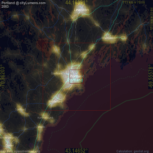
» NASA city lights 2003
» Earth at Night: Flat Maps 2012, 2016