Virginia Beach night lights from space
Night Light of Virginia Beach (Virginia) from space (United States) Src. Average luminocity for 10x10km area is 49.6623% and for 50x50km: 24.2877%.
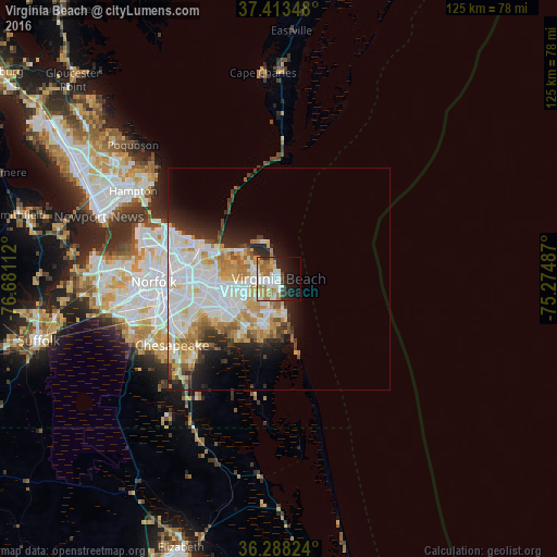
Analysis of Virginia Beach night lights 2016
Square area 10x10 km:
 11.53%
90-99
11.36%80-89
5.19%70-79
7.47%60-69
10.55%50-59
4.22%40-49
2.11%30-39
3.9%20-29
10.55%10-19
16.4%0-9
16.72%Square area 50x50 km:
7.39%90-99
6%80-89
2.68%70-79
3.51%60-69
2.79%50-59
1.64%40-49
1.46%30-39
2.03%20-29
3.85%10-19
5.58%0-9
63.08%Clear (daylight) street map image can be seen on geolist.org.
Map coordinates:
37° 24' 48.5" North, 76° 40' 52" West
36° 51' 10.5" North, 75° 58' 40.8" West
36° 17' 17.7" North, 75° 16' 29.5" West
Some cities around Virginia Beach sort by population:
• Norfolk
27.3 km =17 mi,  268°
268°
• Chesapeake
26.7 km =16.6 mi,  261°
261°
• Newport News
50.6 km =31.4 mi,  300°
300°
• East Hampton
37.5 km =23.3 mi, 303°
• Hampton
38.1 km =23.7 mi, 301°
• Portsmouth Heights
35 km =21.7 mi, 264°
• Portsmouth
28.6 km =17.8 mi, 266°
• Poquoson
44.3 km =27.5 mi,  312°
312°
4791259 (p: 452,745)
Sources (retrieved 2019-11-25):
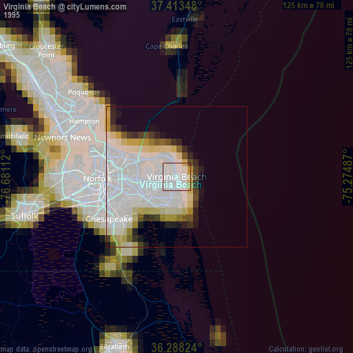
» NASA, Earths city lights 1995
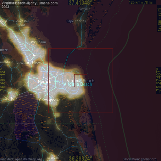
» NASA city lights 2003
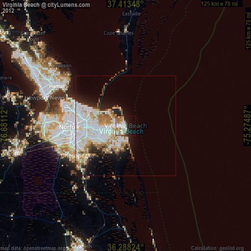
» Earth at Night: Flat Maps 2012, 2016