Portsmouth night lights from space
Night Light of Portsmouth (Virginia) from space (United States) Src. Average luminocity for 10x10km area is 98.1331% and for 50x50km: 46.7873%.
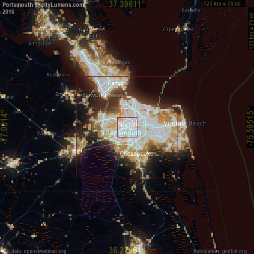
Analysis of Portsmouth night lights 2016
Square area 10x10 km:
 62.82%
90-99
31.17%80-89
2.92%70-79
3.08%60-69
0%50-59
0%40-49
0%30-39
0%20-29
0%10-19
0%0-9
0%Square area 50x50 km:
13.99%90-99
11.84%80-89
4.83%70-79
6.56%60-69
4.68%50-59
3.18%40-49
3.33%30-39
5%20-29
8.96%10-19
11.94%0-9
25.69%Clear (daylight) street map image can be seen on geolist.org.
Map coordinates:
37° 23' 46" North, 77° 0' 5" West
36° 50' 7.5" North, 76° 17' 53.8" West
36° 16' 14.2" North, 75° 35' 42.5" West
Some cities around Portsmouth sort by population:
• Virginia Beach
28.6 km =17.8 mi,  86°
86°
• Norfolk
1.7 km =1.1 mi,  42°
42°
• Chesapeake
2.8 km =1.7 mi,  131°
131°
• Newport News
31.5 km =19.6 mi,  331°
331°
• East Hampton
22.6 km =14 mi,  352°
352°
• Hampton
22 km =13.7 mi, 349°
• Suffolk
28.2 km =17.5 mi,  245°
245°
• South Suffolk
29.1 km =18.1 mi,  243°
243°
4779999 (p: 96,201)
Sources (retrieved 2019-11-25):
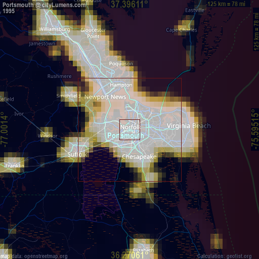
» NASA, Earths city lights 1995
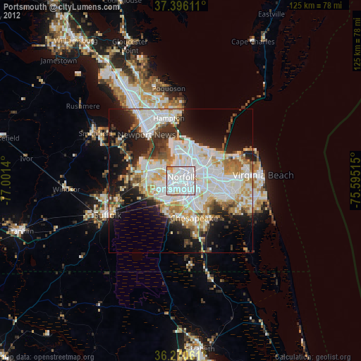
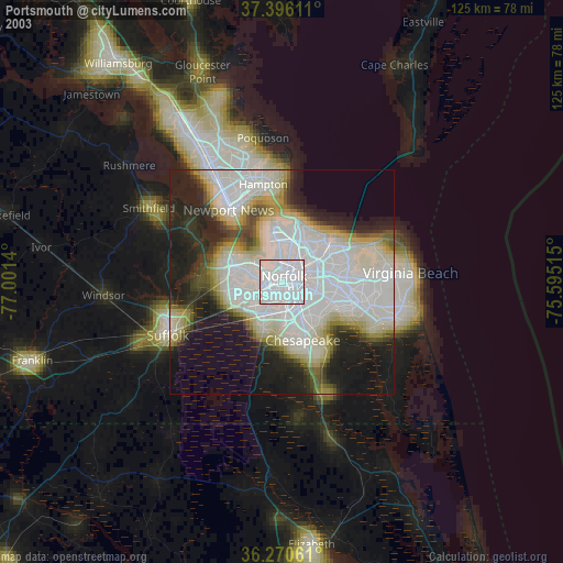
» NASA city lights 2003
» Earth at Night: Flat Maps 2012, 2016