Surprise night lights from space
Night Light of Surprise (Arizona) from space (United States) Src. Average luminocity for 10x10km area is 85.0916% and for 50x50km: 52.1642%.
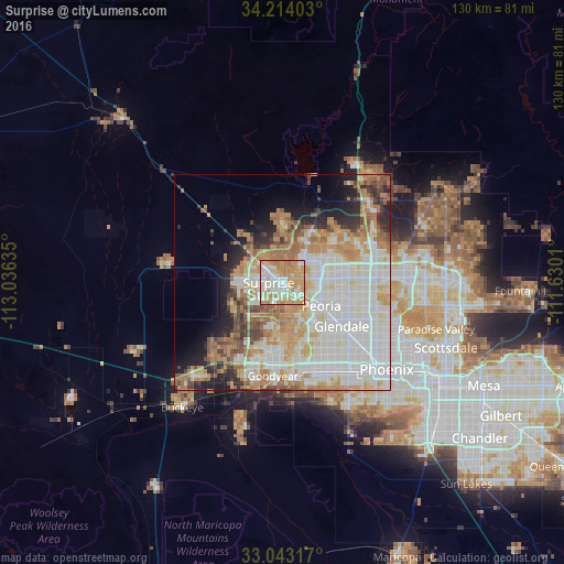
Analysis of Surprise night lights 2016
Square area 10x10 km:
 20.7%
20.7%90-99
24.73%80-89
10.62%70-79
32.97%60-69
10.44%50-59
0.55%40-49
0%30-39
0%20-29
0%10-19
0%0-9
0%Square area 50x50 km:
15.03%90-99
14.23%80-89
5.28%70-79
8.38%60-69
8.12%50-59
4.65%40-49
3.4%30-39
2.6%20-29
4.82%10-19
6.18%0-9
27.3%Clear (daylight) street map image can be seen on geolist.org.
Map coordinates:
34° 12' 50.5" North, 113° 2' 10.9" West
33° 37' 50.1" North, 112° 19' 59.6" West
33° 2' 35.4" North, 111° 37' 48.4" West
Some cities around Surprise sort by population:
• Glendale
17 km =10.6 mi,  126°
126°
• Peoria
10.5 km =6.5 mi,  122°
122°
• Deer Valley
19.3 km =12 mi,  72°
72°
• Sun City
6.8 km =4.2 mi, 122°
• El Mirage
2.1 km =1.3 mi,  157°
157°
• Sun City West
3.6 km =2.2 mi,  347°
347°
• Youngtown
4.9 km =3 mi,  145°
145°
• Litchfield Park
15.4 km =9.6 mi,  188°
188°
5316428 (p: 128,422)
Sources (retrieved 2019-11-25):
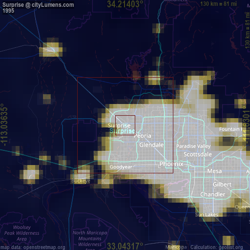
» NASA, Earths city lights 1995
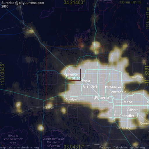
» NASA city lights 2003
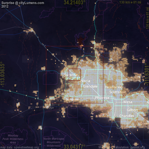
» Earth at Night: Flat Maps 2012, 2016