Deer Valley night lights from space
Night Light of Deer Valley (Arizona) from space (United States) Src. Average luminocity for 10x10km area is 87.6282% and for 50x50km: 60.9697%.
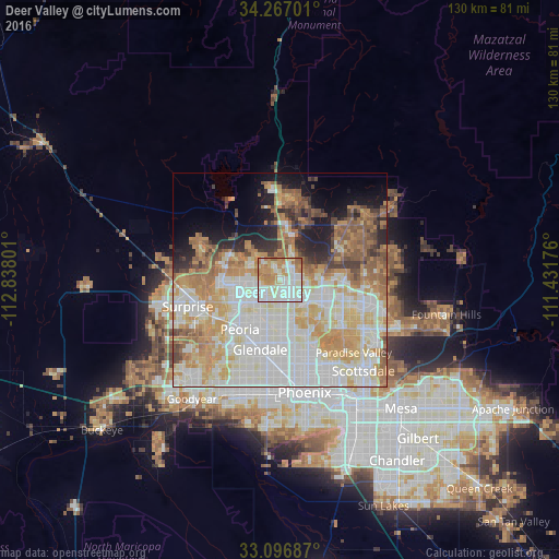
Analysis of Deer Valley night lights 2016
Square area 10x10 km:
 28.39%
90-99
28.75%80-89
13.19%70-79
13%60-69
15.2%50-59
1.47%40-49
0%30-39
0%20-29
0%10-19
0%0-9
0%Square area 50x50 km:
16.38%90-99
16.65%80-89
7.69%70-79
10.52%60-69
9.03%50-59
6.46%40-49
3.24%30-39
2.79%20-29
4.49%10-19
6.61%0-9
16.14%Clear (daylight) street map image can be seen on geolist.org.
Map coordinates:
34° 16' 1.2" North, 112° 50' 16.8" West
33° 41' 2.1" North, 112° 8' 5.6" West
33° 5' 48.7" North, 111° 25' 54.3" West
Some cities around Deer Valley sort by population:
• Glendale
16.8 km =10.4 mi,  196°
196°
• Peoria
14.9 km =9.3 mi,  219°
219°
• Surprise
19.3 km =12 mi,  252°
252°
• Sun City
15.9 km =9.9 mi,  232°
232°
• El Mirage
19.2 km =11.9 mi, 245°
• Sun City West
19.3 km =12 mi,  262°
262°
• Anthem
20.4 km =12.7 mi,  356°
356°
• Youngtown
18.5 km =11.5 mi,  237°
237°
5292387 (p: 165,656)
Sources (retrieved 2019-11-25):
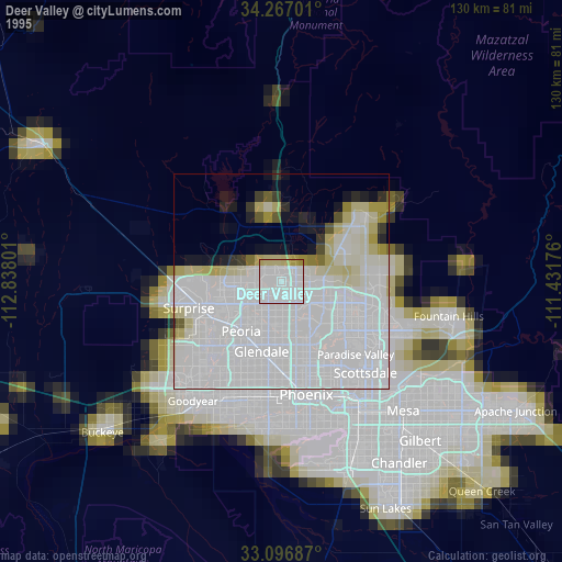
» NASA, Earths city lights 1995
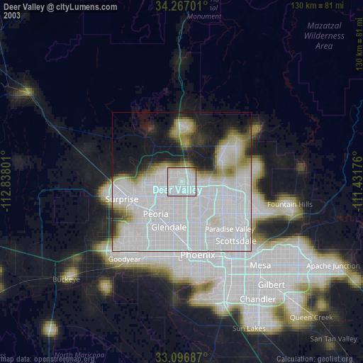
» NASA city lights 2003
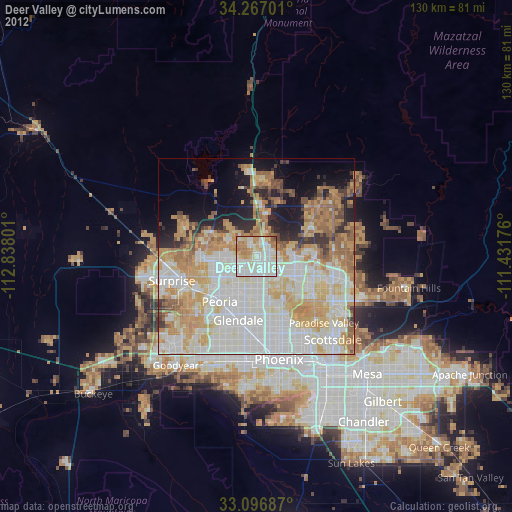
» Earth at Night: Flat Maps 2012, 2016