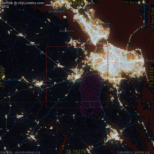
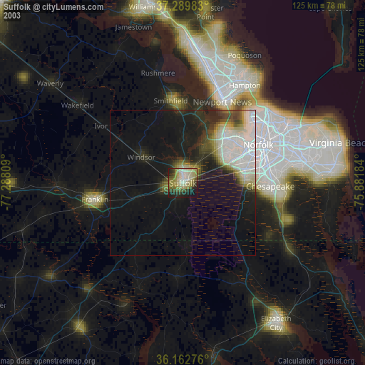
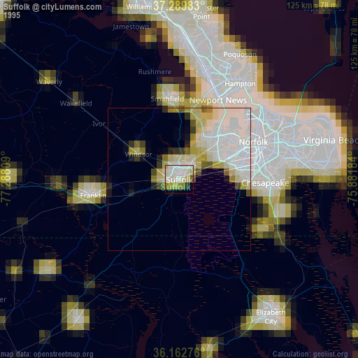
Suffolk night lights from space
Night Light of Suffolk (Virginia) from space (United States) Src. Average luminocity for 10x10km area is 52.3182% and for 50x50km: 17.7324%.
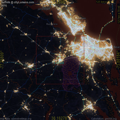
Analysis of Suffolk night lights 2016
Square area 10x10 km:
 6.82%
6.82%90-99
5.24%80-89
9.62%70-79
12.24%60-69
9.44%50-59
11.01%40-49
6.64%30-39
6.82%20-29
13.99%10-19
15.73%0-9
2.45%Square area 50x50 km:
3.14%90-99
3.4%80-89
2.17%70-79
3.22%60-69
2.31%50-59
1.76%40-49
1.84%30-39
2.51%20-29
5.08%10-19
7.83%0-9
66.76%Clear (daylight) street map image can be seen on geolist.org.
Map coordinates:
37° 17' 23.4" North, 77° 17' 17.1" West
36° 43' 42.1" North, 76° 35' 5.9" West
36° 9' 45.9" North, 75° 52' 54.6" West
Some cities around Suffolk sort by population:
• Norfolk
29.8 km =18.5 mi,  63°
63°
• Chesapeake
29.4 km =18.3 mi,  69°
69°
• Hampton
39.7 km =24.7 mi,  32°
32°
• Portsmouth Heights
21.8 km =13.5 mi, 61°
• Portsmouth
28.2 km =17.5 mi, 65°
• South Suffolk
1.3 km =0.8 mi,  200°
200°
• Franklin
30.6 km =19 mi,  259°
259°
• Smithfield
28.5 km =17.7 mi,  351°
351°
4788158 (p: 88,161)
Sources (retrieved 2019-11-25):
» NASA, Earths city lights 1995
» NASA city lights 2003
» Earth at Night: Flat Maps 2012, 2016