Spring Valley night lights from space
Night Light of Spring Valley (Nevada) from space (United States) Src. Average luminocity for 10x10km area is 99.7473% and for 50x50km: 46.1762%.
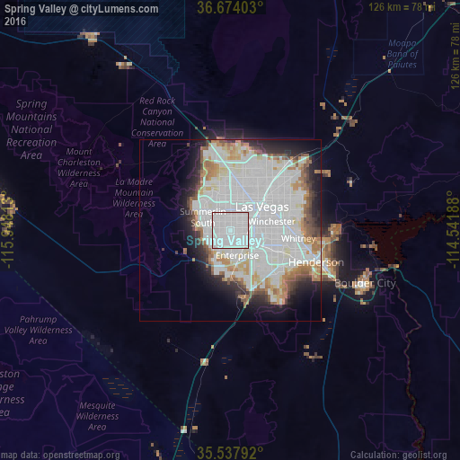
Analysis of Spring Valley night lights 2016
Square area 10x10 km:
 86.45%
90-99
13.55%80-89
0%70-79
0%60-69
0%50-59
0%40-49
0%30-39
0%20-29
0%10-19
0%0-9
0%Square area 50x50 km:
21.72%90-99
11.62%80-89
2.98%70-79
2.57%60-69
4.29%50-59
2.73%40-49
2.27%30-39
2.5%20-29
4.75%10-19
7.11%0-9
37.46%Clear (daylight) street map image can be seen on geolist.org.
Map coordinates:
36° 40' 26.5" North, 115° 56' 53.3" West
36° 6' 28.9" North, 115° 14' 42" West
35° 32' 16.5" North, 114° 32' 30.8" West
Some cities around Spring Valley sort by population:
• Las Vegas
12.2 km =7.6 mi,  52°
52°
• North Las Vegas
15.3 km =9.5 mi, 48°
• Paradise
8.9 km =5.5 mi,  97°
97°
• Sunrise Manor
19.2 km =11.9 mi, 53°
• Enterprise
9.2 km =5.7 mi,  178°
178°
• Whitney
18.8 km =11.7 mi,  93°
93°
• Winchester
11.6 km =7.2 mi,  77°
77°
• Summerlin South
7.7 km =4.8 mi,  277°
277°
5512909 (p: 178,395)
Sources (retrieved 2019-11-25):
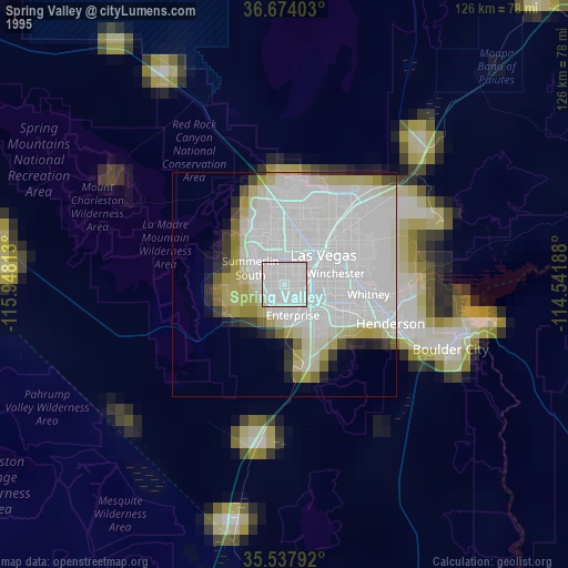
» NASA, Earths city lights 1995
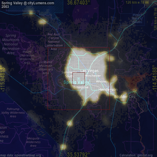
» NASA city lights 2003
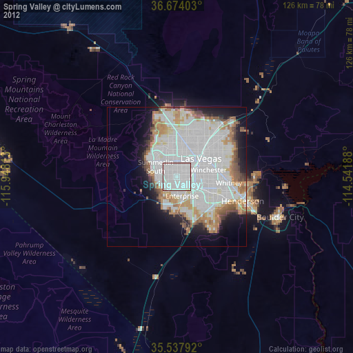
» Earth at Night: Flat Maps 2012, 2016