North Las Vegas night lights from space
Night Light of North Las Vegas (Nevada) from space (United States) Src. Average luminocity for 10x10km area is 99.7045% and for 50x50km: 47.6468%.
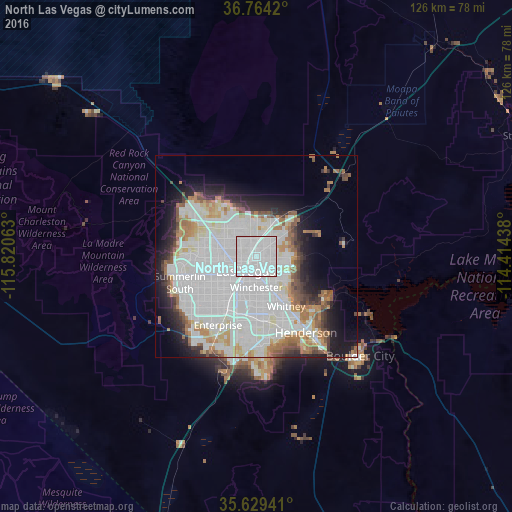
Analysis of North Las Vegas night lights 2016
Square area 10x10 km:
 83.57%
90-99
16.43%80-89
0%70-79
0%60-69
0%50-59
0%40-49
0%30-39
0%20-29
0%10-19
0%0-9
0%Square area 50x50 km:
21.81%90-99
11.84%80-89
3.03%70-79
2.64%60-69
4.87%50-59
3.07%40-49
2.49%30-39
2.58%20-29
4.9%10-19
8.22%0-9
34.56%Clear (daylight) street map image can be seen on geolist.org.
Map coordinates:
36° 45' 51.1" North, 115° 49' 14.3" West
36° 11' 55.9" North, 115° 7' 3" West
35° 37' 45.9" North, 114° 24' 51.8" West
Some cities around North Las Vegas sort by population:
• Las Vegas
3.2 km =2 mi,  213°
213°
• Henderson
21.5 km =13.4 mi,  145°
145°
• Paradise
11.6 km =7.2 mi,  193°
193°
• Sunrise Manor
4.2 km =2.6 mi,  71°
71°
• Spring Valley
15.3 km =9.5 mi,  228°
228°
• Whitney
13.3 km =8.3 mi, 146°
• Winchester
7.7 km =4.8 mi,  180°
180°
• Summerlin South
21.1 km =13.1 mi,  244°
244°
5509403 (p: 234,807)
Sources (retrieved 2019-11-25):
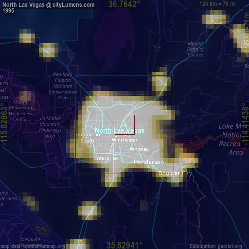
» NASA, Earths city lights 1995
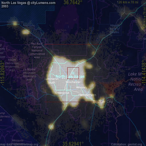
» NASA city lights 2003
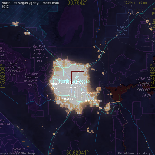
» Earth at Night: Flat Maps 2012, 2016