Shoreline night lights from space
Night Light of Shoreline (Washington) from space (United States) Src. Average luminocity for 10x10km area is 68.9509% and for 50x50km: 37.803%.
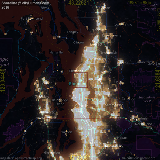
Analysis of Shoreline night lights 2016
Square area 10x10 km:
 15.48%
90-99
18.15%80-89
6.4%70-79
11.76%60-69
18.45%50-59
6.4%40-49
3.87%30-39
4.76%20-29
8.93%10-19
5.8%0-9
0%Square area 50x50 km:
9.71%90-99
8.39%80-89
3.03%70-79
4.82%60-69
6.19%50-59
4.38%40-49
4.84%30-39
5.59%20-29
6.07%10-19
8.69%0-9
38.28%Clear (daylight) street map image can be seen on geolist.org.
Map coordinates:
48° 13' 34.4" North, 123° 2' 40.7" West
47° 45' 20.3" North, 122° 20' 29.5" West
47° 16' 50.9" North, 121° 38' 18.2" West
Some cities around Shoreline sort by population:
• Edmonds
6.7 km =4.2 mi,  336°
336°
• Lynnwood
7.5 km =4.7 mi,  15°
15°
• Inglewood-Finn Hill
9.1 km =5.7 mi,  115°
115°
• Kenmore
7.3 km =4.5 mi,  88°
88°
• Mountlake Terrace
4.4 km =2.7 mi,  34°
34°
• Lake Forest Park
4.5 km =2.8 mi, 88°
• Alderwood Manor
8.6 km =5.3 mi, 31°
• Brier
6 km =3.7 mi,  57°
57°
5810301 (p: 55,439)
Sources (retrieved 2019-11-25):
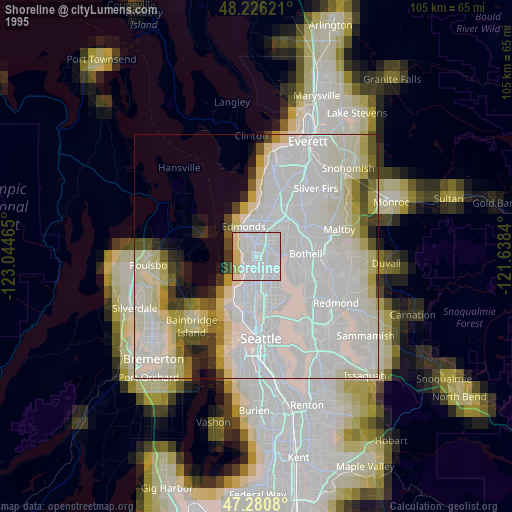
» NASA, Earths city lights 1995
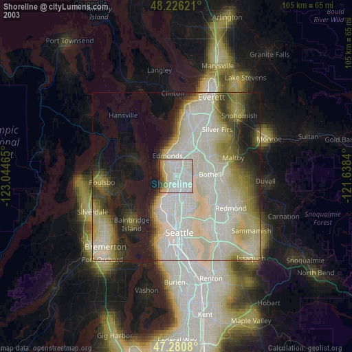
» NASA city lights 2003
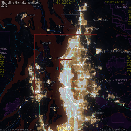
» Earth at Night: Flat Maps 2012, 2016