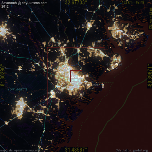
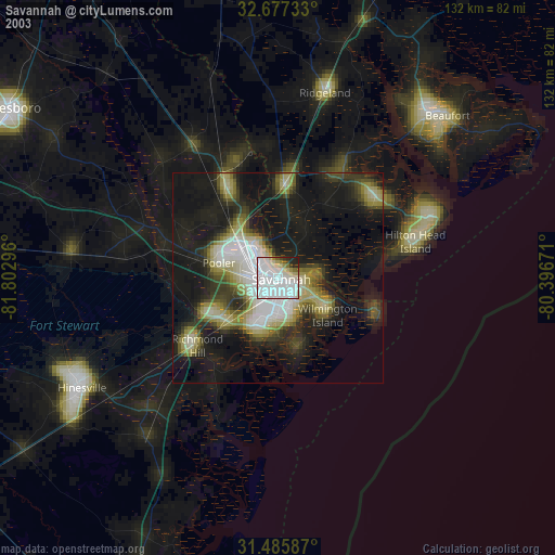
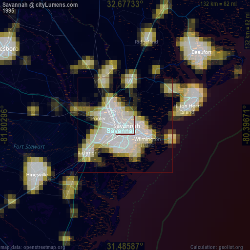
Savannah night lights from space
Night Light of Savannah (Georgia) from space (United States) Src. Average luminocity for 10x10km area is 80.4755% and for 50x50km: 29.879%.

Analysis of Savannah night lights 2016
Square area 10x10 km:
 34.27%
90-99
28.67%80-89
2.8%70-79
4.37%60-69
7.87%50-59
2.8%40-49
5.77%30-39
4.2%20-29
5.94%10-19
3.32%0-9
0%Square area 50x50 km:
4.67%90-99
4.51%80-89
3.28%70-79
6.26%60-69
6%50-59
2.38%40-49
3.25%30-39
4.64%20-29
7.31%10-19
16.6%0-9
41.1%Clear (daylight) street map image can be seen on geolist.org.
Map coordinates:
32° 40' 38.4" North, 81° 48' 10.7" West
32° 5' 0.7" North, 81° 5' 59.4" West
31° 29' 9.1" North, 80° 23' 48.2" West
Some cities around Savannah sort by population:
• Pooler
14.3 km =8.9 mi,  284°
284°
• Wilmington Island
14.8 km =9.2 mi,  126°
126°
• Georgetown
16.4 km =10.2 mi,  227°
227°
• Garden City
6.1 km =3.8 mi,  303°
303°
• Skidaway Island
17.3 km =10.7 mi,  163°
163°
• Port Wentworth
9.4 km =5.8 mi,  320°
320°
• Whitemarsh Island
9.9 km =6.2 mi, 127°
• Hardeeville
22.7 km =14.1 mi,  4°
4°
4221552 (p: 145,674)
Sources (retrieved 2019-11-25):
» NASA, Earths city lights 1995
» NASA city lights 2003
» Earth at Night: Flat Maps 2012, 2016