Pooler night lights from space
Night Light of Pooler (Georgia) from space (United States) Src. Average luminocity for 10x10km area is 75.8951% and for 50x50km: 27.9473%.
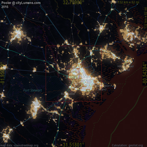
Analysis of Pooler night lights 2016
Square area 10x10 km:
 17.13%
90-99
16.43%80-89
12.41%70-79
18.36%60-69
18.88%50-59
5.24%40-49
2.27%30-39
3.5%20-29
5.77%10-19
0%0-9
0%Square area 50x50 km:
4.54%90-99
4.33%80-89
2.76%70-79
5.47%60-69
5.41%50-59
2.32%40-49
3.13%30-39
4.37%20-29
7.04%10-19
15.35%0-9
45.27%Clear (daylight) street map image can be seen on geolist.org.
Map coordinates:
32° 42' 32.6" North, 81° 57' 0.7" West
32° 6' 55.7" North, 81° 14' 49.4" West
31° 31' 4.8" North, 80° 32' 38.2" West
Some cities around Pooler sort by population:
• Savannah
14.3 km =8.9 mi,  104°
104°
• Richmond Hill
20.4 km =12.7 mi,  195°
195°
• Georgetown
14.8 km =9.2 mi,  172°
172°
• Rincon
20.1 km =12.5 mi,  3°
3°
• Garden City
8.8 km =5.5 mi,  90°
90°
• Port Wentworth
8.7 km =5.4 mi,  64°
64°
• Whitemarsh Island
23.7 km =14.7 mi,  113°
113°
• Hardeeville
24.7 km =15.3 mi,  39°
39°
4216948 (p: 23,133)
Sources (retrieved 2019-11-25):
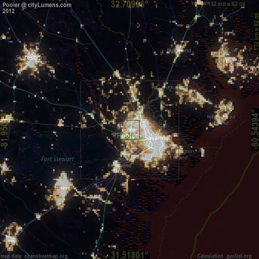
» Earth at Night: Flat Maps 2012, 2016