Petersburg night lights from space
Night Light of Petersburg (Virginia) from space (United States) Src. Average luminocity for 10x10km area is 78.0901% and for 50x50km: 22.3358%.
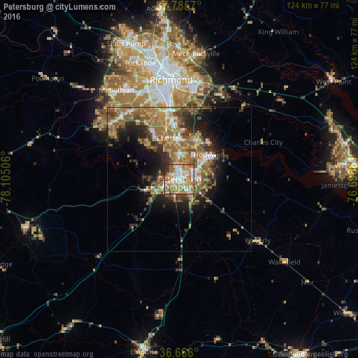
Analysis of Petersburg night lights 2016
Square area 10x10 km:
 18.03%
90-99
19.73%80-89
11.39%70-79
19.73%60-69
14.97%50-59
6.8%40-49
4.42%30-39
2.89%20-29
2.04%10-19
0%0-9
0%Square area 50x50 km:
2.47%90-99
2.59%80-89
2.56%70-79
4.34%60-69
5.23%50-59
5.62%40-49
3.16%30-39
3.61%20-29
5%10-19
7.54%0-9
57.87%Clear (daylight) street map image can be seen on geolist.org.
Map coordinates:
37° 47' 8.5" North, 78° 6' 18.2" West
37° 13' 40.5" North, 77° 24' 6.9" West
36° 39' 57.6" North, 76° 41' 55.7" West
Some cities around Petersburg sort by population:
• Hopewell
13.2 km =8.2 mi,  50°
50°
• Chester
14.8 km =9.2 mi,  346°
346°
• Meadowbrook
25.4 km =15.8 mi, 345°
• Colonial Heights
4.5 km =2.8 mi, 353°
• Fort Lee
30.4 km =18.9 mi,  11°
11°
• Ettrick
2.8 km =1.7 mi,  298°
298°
• Bellwood
21.8 km =13.5 mi, 351°
• Bensley
24.6 km =15.3 mi, 351°
4778626 (p: 32,477)
Sources (retrieved 2019-11-25):
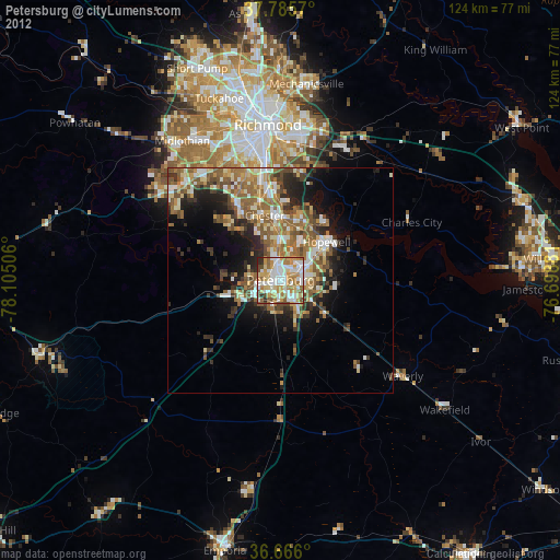
» Earth at Night: Flat Maps 2012, 2016