Hot Springs night lights from space
Night Light of Hot Springs (Arkansas) from space (United States) Src. Average luminocity for 10x10km area is 62.8304% and for 50x50km: 10.9475%.

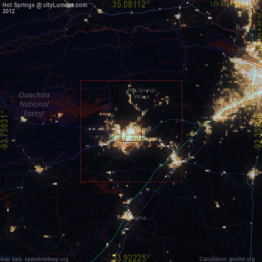
Analysis of Hot Springs night lights 2016
Square area 10x10 km:
 12.59%
90-99
13.99%80-89
7.69%70-79
6.99%60-69
11.54%50-59
16.26%40-49
5.42%30-39
6.12%20-29
13.64%10-19
5.77%0-9
0%Square area 50x50 km:
0.74%90-99
1.09%80-89
1.17%70-79
0.94%60-69
1.72%50-59
3.07%40-49
2.2%30-39
3%20-29
2.86%10-19
7.2%0-9
76.01%Clear (daylight) street map image can be seen on geolist.org.
Map coordinates:
35° 4' 52" North, 93° 45' 29.9" West
34° 30' 13.3" North, 93° 3' 18.6" West
33° 55' 20.1" North, 92° 21' 7.4" West
Some cities around Hot Springs sort by population:
• Little Rock
75.1 km =46.7 mi,  68°
68°
• Benton
43.4 km =27 mi,  81°
81°
• Bryant
52.9 km =32.9 mi, 78°
• Maumelle
71.9 km =44.7 mi,  55°
55°
• Malvern
27.2 km =16.9 mi,  125°
125°
• Arkadelphia
42.6 km =26.5 mi,  179°
179°
• East End
65.6 km =40.8 mi,  85°
85°
• Morrilton
77.4 km =48.1 mi,  21°
21°
4115412 (p: 35,635)
Sources (retrieved 2019-11-25):
» Earth at Night: Flat Maps 2012, 2016