Garfield night lights from space
Night Light of Garfield (New Jersey) from space (United States) Src. Average luminocity for 10x10km area is 99.3878% and for 50x50km: 80.685%.
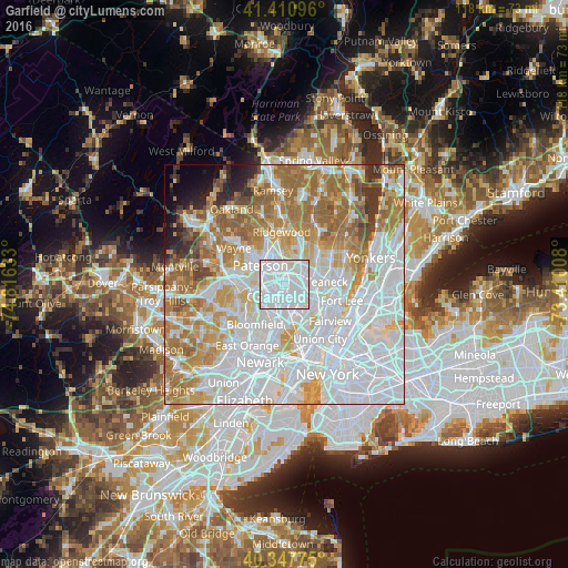
Analysis of Garfield night lights 2016
Square area 10x10 km:
 79.59%
90-99
19.9%80-89
0.51%70-79
0%60-69
0%50-59
0%40-49
0%30-39
0%20-29
0%10-19
0%0-9
0%Square area 50x50 km:
35.82%90-99
17.43%80-89
7.76%70-79
10.06%60-69
12.5%50-59
5.49%40-49
2.41%30-39
2.41%20-29
2.03%10-19
2.11%0-9
1.98%Clear (daylight) street map image can be seen on geolist.org.
Map coordinates:
41° 24' 39.5" North, 74° 48' 58.8" West
40° 52' 53.4" North, 74° 6' 47.5" West
40° 20' 51.9" North, 73° 24' 36.3" West
Some cities around Garfield sort by population:
• Passaic
3 km =1.9 mi,  205°
205°
• Lodi
2.5 km =1.6 mi,  87°
87°
• Elmwood Park
2.5 km =1.6 mi,  349°
349°
• Saddle Brook
2.6 km =1.6 mi,  41°
41°
• Hasbrouck Heights
3.8 km =2.4 mi,  133°
133°
• Wallington
3.2 km =2 mi,  180°
180°
• Wood-Ridge
4.5 km =2.8 mi,  151°
151°
• Rochelle Park
4.3 km =2.7 mi,  48°
48°
5098343 (p: 31,802)
Sources (retrieved 2019-11-25):
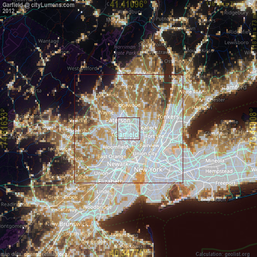
» Earth at Night: Flat Maps 2012, 2016