Flint night lights from space
Night Light of Flint (Michigan) from space (United States) Src. Average luminocity for 10x10km area is 93.946% and for 50x50km: 20.1045%.
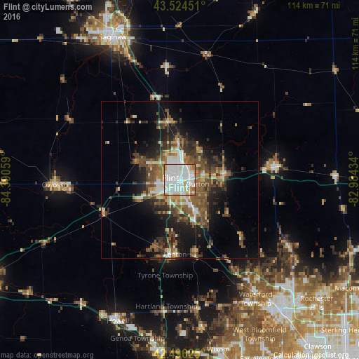
Analysis of Flint night lights 2016
Square area 10x10 km:
 41.11%
90-99
39.37%80-89
6.35%70-79
6.51%60-69
5.24%50-59
1.43%40-49
0%30-39
0%20-29
0%10-19
0%0-9
0%Square area 50x50 km:
2.76%90-99
3.58%80-89
1.89%70-79
1.8%60-69
3.06%50-59
4.05%40-49
4.35%30-39
3.74%20-29
4.83%10-19
9.43%0-9
60.51%Clear (daylight) street map image can be seen on geolist.org.
Map coordinates:
43° 31' 28.2" North, 84° 23' 26.1" West
43° 0' 45.1" North, 83° 41' 14.9" West
42° 29' 46.5" North, 82° 59' 3.6" West
Some cities around Flint sort by population:
• Burton
6 km =3.7 mi,  104°
104°
• Fenton
23.9 km =14.9 mi,  183°
183°
• Beecher
8.6 km =5.3 mi,  356°
356°
• Flushing
14.4 km =8.9 mi,  292°
292°
• Grand Blanc
10.5 km =6.5 mi,  153°
153°
• Holly
25 km =15.5 mi,  168°
168°
• Swartz Creek
13.2 km =8.2 mi,  242°
242°
• Lake Fenton
18.6 km =11.6 mi,  185°
185°
4992982 (p: 98,310)
Sources (retrieved 2019-11-25):
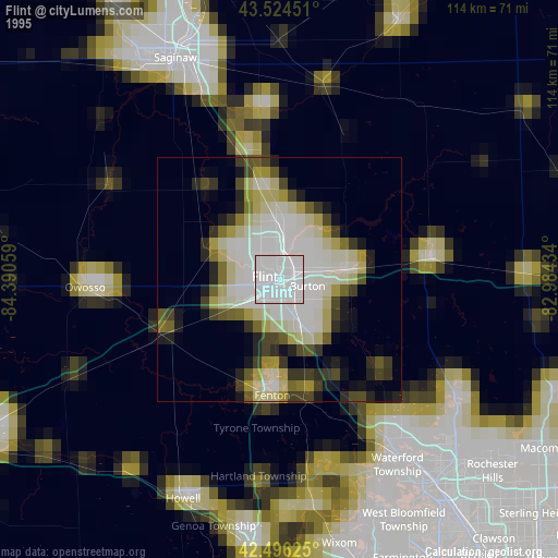
» NASA, Earths city lights 1995
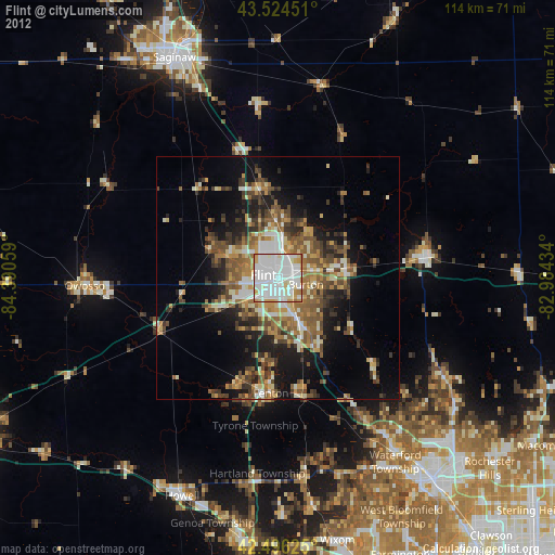
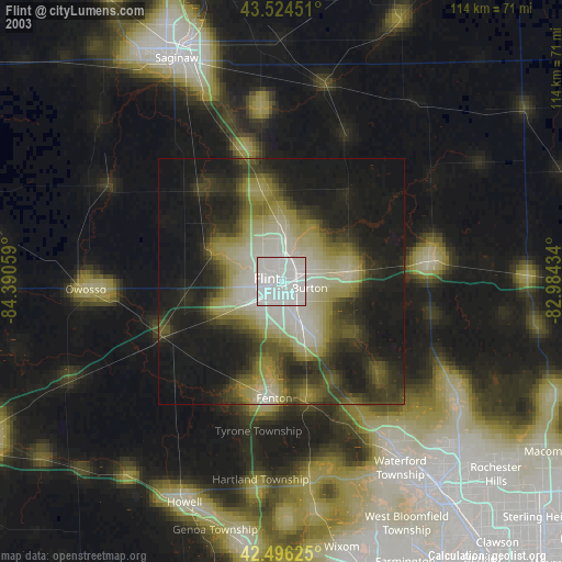
» NASA city lights 2003
» Earth at Night: Flat Maps 2012, 2016