Camp Hill night lights from space
Night Light of Camp Hill (Pennsylvania) from space (United States) Src. Average luminocity for 10x10km area is 81.4123% and for 50x50km: 26.6557%.
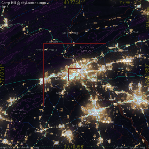
Analysis of Camp Hill night lights 2016
Square area 10x10 km:
 23.05%
90-99
21.75%80-89
9.9%70-79
14.77%60-69
17.69%50-59
6.82%40-49
4.22%30-39
1.79%20-29
0%10-19
0%0-9
0%Square area 50x50 km:
4.15%90-99
4.28%80-89
3.42%70-79
3.36%60-69
4.06%50-59
4.14%40-49
3.85%30-39
4.38%20-29
8.37%10-19
14.59%0-9
45.4%Clear (daylight) street map image can be seen on geolist.org.
Map coordinates:
40° 46' 27.9" North, 77° 37' 23.2" West
40° 14' 23.3" North, 76° 55' 11.9" West
39° 42' 3.5" North, 76° 13' 0.7" West
Some cities around Camp Hill sort by population:
• Harrisburg
4.8 km =3 mi,  38°
38°
• Colonial Park
11.5 km =7.1 mi,  54°
54°
• Progress
9 km =5.6 mi,  56°
56°
• Mechanicsburg
8 km =5 mi,  249°
249°
• New Cumberland
3.1 km =1.9 mi,  105°
105°
• Lower Allen
2.2 km =1.4 mi,  131°
131°
• Enola
5.7 km =3.5 mi,  348°
348°
• Steelton
6.7 km =4.2 mi,  94°
94°
5182928 (p: 7,923)
Sources (retrieved 2019-11-25):
» Earth at Night: Flat Maps 2012, 2016