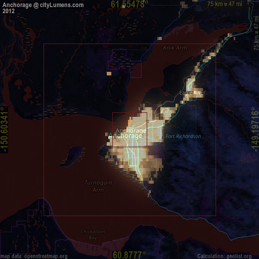
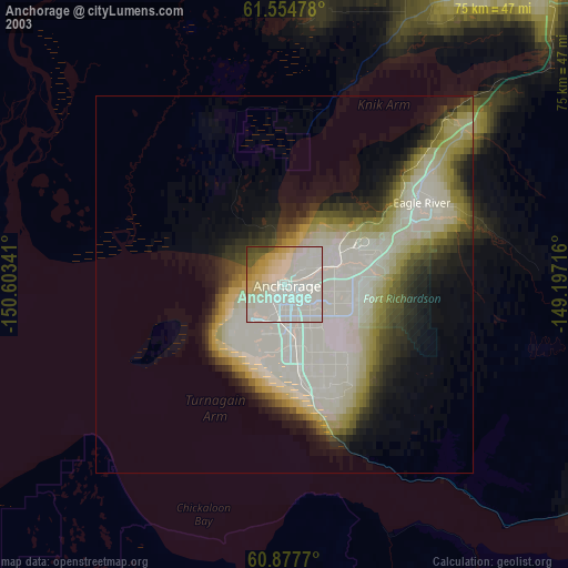
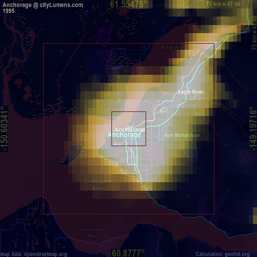
Anchorage night lights from space
Night Light of Anchorage (Alaska) from space (United States) Src. Average luminocity for 10x10km area is 72.6426% and for 50x50km: 12.8289%.
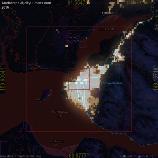
Analysis of Anchorage night lights 2016
Square area 10x10 km:
 43.6%
43.6%90-99
16.74%80-89
3.2%70-79
2.38%60-69
0.41%50-59
2.07%40-49
0.72%30-39
7.95%20-29
9.61%10-19
8.16%0-9
5.17%Square area 50x50 km:
4.22%90-99
3.24%80-89
0.88%70-79
0.85%60-69
1.13%50-59
0.75%40-49
0.87%30-39
1.4%20-29
2.96%10-19
6.41%0-9
77.3%Clear (daylight) street map image can be seen on geolist.org.
Map coordinates:
61° 33' 17.2" North, 150° 36' 12.3" West
61° 13' 5" North, 149° 54' 1" West
60° 52' 39.7" North, 149° 11' 49.8" West
Some cities around Anchorage sort by population:
• Eagle River
21.2 km =13.2 mi,  57°
57°
• Knik-Fairview
36.4 km =22.6 mi,  26°
26°
• Wasilla
47.2 km =29.3 mi, 31°
• Lakes
53.5 km =33.2 mi,  36°
36°
• Tanaina
51.9 km =32.2 mi, 28°
• Meadow Lakes
47.9 km =29.8 mi,  19°
19°
• Elmendorf Air Force Base
15 km =9.3 mi,  73°
73°
• Gateway
52.8 km =32.8 mi, 41°
5879400 (p: 298,695)
Sources (retrieved 2019-11-25):
» NASA, Earths city lights 1995
» NASA city lights 2003
» Earth at Night: Flat Maps 2012, 2016