Knik-Fairview night lights from space
Night Light of Knik-Fairview (Alaska) from space (United States) Src. Average luminocity for 10x10km area is 12.295% and for 50x50km: 6.3665%.
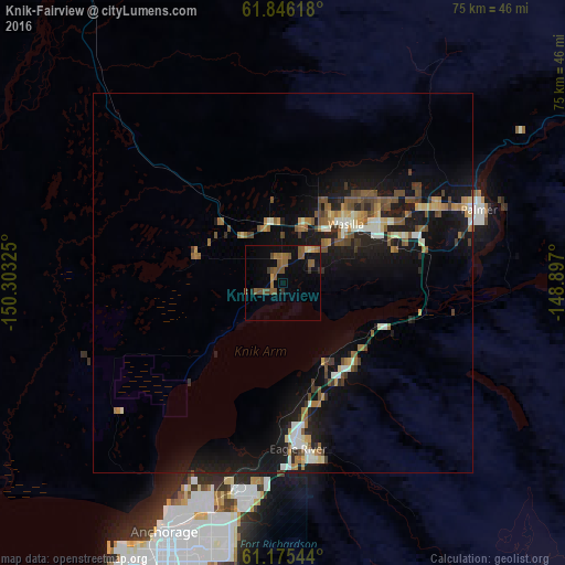
Analysis of Knik-Fairview night lights 2016
Square area 10x10 km:
 0%
0%90-99
0.21%80-89
0.83%70-79
0.62%60-69
2.59%50-59
7.35%40-49
2.9%30-39
0.93%20-29
1.14%10-19
6.31%0-9
77.12%Square area 50x50 km:
0.13%90-99
1.22%80-89
0.56%70-79
0.66%60-69
1.03%50-59
1.25%40-49
1.1%30-39
0.59%20-29
1.17%10-19
7.21%0-9
85.09%Clear (daylight) street map image can be seen on geolist.org.
Map coordinates:
61° 50' 46.2" North, 150° 18' 11.7" West
61° 30' 45.4" North, 149° 36' 0.4" West
61° 10' 31.6" North, 148° 53' 49.2" West
Some cities around Knik-Fairview sort by population:
• Eagle River
21.3 km =13.2 mi,  175°
175°
• Wasilla
11.3 km =7 mi,  47°
47°
• Lakes
18.7 km =11.6 mi,  55°
55°
• Tanaina
15.6 km =9.7 mi,  35°
35°
• Meadow Lakes
12.5 km =7.8 mi,  359°
359°
• Palmer
27.5 km =17.1 mi,  69°
69°
• Elmendorf Air Force Base
28.5 km =17.7 mi, 183°
• Gateway
20.2 km =12.6 mi, 70°
7262897 (p: 14,923)
Sources (retrieved 2019-11-25):
» Earth at Night: Flat Maps 2012, 2016