Njeru night lights from space
Night Light of Njeru (Central Region) from space (Uganda) Src. Average luminocity for 10x10km area is 8.6515% and for 50x50km: 1.1385%.
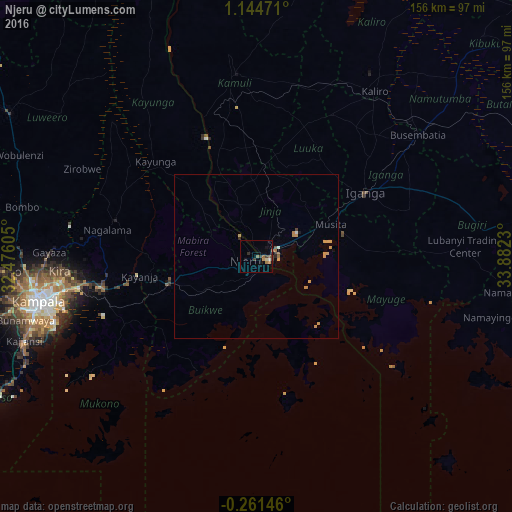
Analysis of Njeru night lights 2016
Square area 10x10 km:
 0.22%
0.22%90-99
0.65%80-89
0.87%70-79
1.73%60-69
1.95%50-59
1.52%40-49
1.08%30-39
2.81%20-29
0.87%10-19
2.16%0-9
86.15%Square area 50x50 km:
0.03%90-99
0.07%80-89
0.04%70-79
0.55%60-69
0.21%50-59
0.13%40-49
0.12%30-39
0.13%20-29
0.13%10-19
0.17%0-9
98.41%Clear (daylight) street map image can be seen on geolist.org.
Map coordinates:
1° 8' 41" North, 32° 28' 33.8" East
0° 26' 30" North, 33° 10' 45" East
0° 15' 41.3" South, 33° 52' 56.3" East
Some cities around Njeru sort by population:
• Jinja
2.7 km =1.7 mi,  96°
96°
• Mukono
48.1 km =29.9 mi,  258°
258°
• Iganga
37.2 km =23.1 mi,  59°
59°
• Lugazi
28.1 km =17.5 mi,  253°
253°
• Kayunga
43.4 km =27 mi,  311°
311°
• Buwenge
23.2 km =14.4 mi,  357°
357°
• Bugembe
8.2 km =5.1 mi, 56°
• Mayuge
33.5 km =20.8 mi,  86°
86°
227812 (p: 61,952)
Sources (retrieved 2019-11-25):
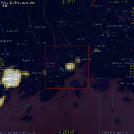
» NASA, Earths city lights 1995
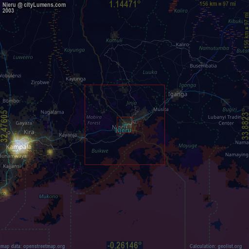
» NASA city lights 2003
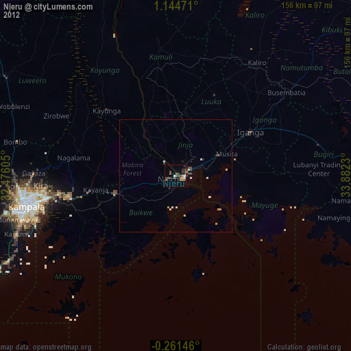
» Earth at Night: Flat Maps 2012, 2016