Yevpatoriya night lights from space
Night Light of Yevpatoriya (Crimea) from space (Ukraine) Src. Average luminocity for 10x10km area is 26.8985% and for 50x50km: 1.661%.
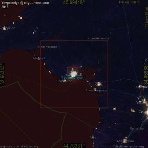
Analysis of Yevpatoriya night lights 2016
Square area 10x10 km:
 5.76%
5.76%90-99
6.36%80-89
1.21%70-79
1.36%60-69
4.85%50-59
2.88%40-49
0.61%30-39
2.73%20-29
1.52%10-19
33.48%0-9
39.24%Square area 50x50 km:
0.23%90-99
0.3%80-89
0.07%70-79
0.15%60-69
0.38%50-59
0.19%40-49
0.13%30-39
0.18%20-29
0.22%10-19
1.42%0-9
96.74%Clear (daylight) street map image can be seen on geolist.org.
Map coordinates:
45° 41' 39.1" North, 32° 39' 48.3" East
45° 12' 3.3" North, 33° 21' 59.6" East
44° 42' 11.9" North, 34° 4' 10.8" East
Some cities around Yevpatoriya sort by population:
• Saki
19.7 km =12.2 mi,  112°
112°
• Hvardiiske
52.2 km =32.4 mi,  100°
100°
• Oktyabr’skoye
61 km =37.9 mi,  80°
80°
• Gresovskiy
56.1 km =34.9 mi, 112°
• Mirnoye
59.7 km =37.1 mi, 113°
• Molodyozhnoye
58.4 km =36.3 mi, 112°
• Vilino
46.2 km =28.7 mi,  148°
148°
• Novofedorovka
20 km =12.4 mi,  126°
126°
688105 (p: 106,202)
Sources (retrieved 2019-11-25):
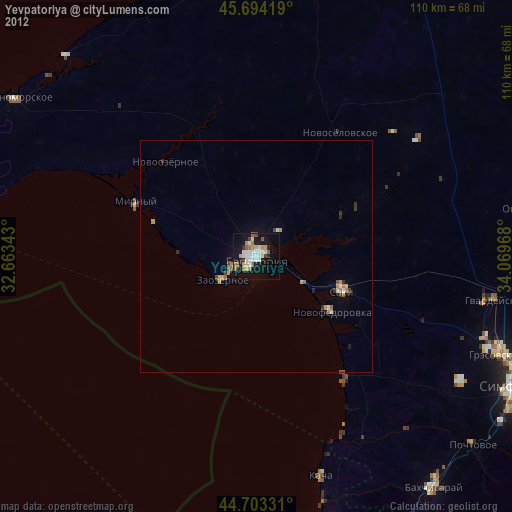
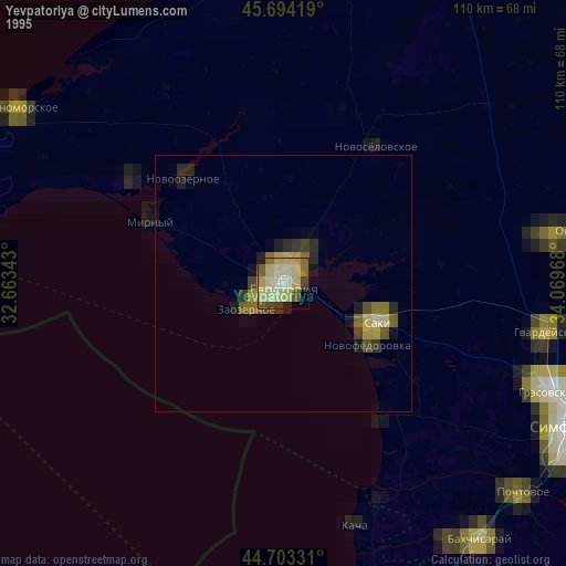
» NASA, Earths city lights 1995
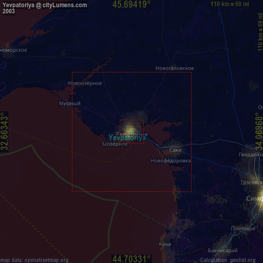
» NASA city lights 2003
» Earth at Night: Flat Maps 2012, 2016