Partenit night lights from space
Night Light of Partenit (Crimea) from space (Ukraine) Src. Average luminocity for 10x10km area is 5.7803% and for 50x50km: 2.2968%.
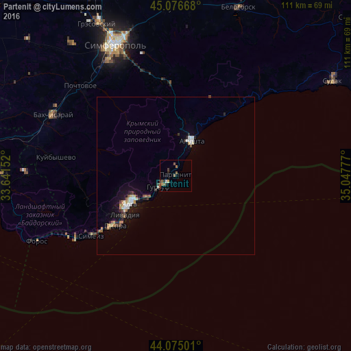
Analysis of Partenit night lights 2016
Square area 10x10 km:
 0.3%
0.3%90-99
0.3%80-89
0.3%70-79
0.61%60-69
1.82%50-59
2.58%40-49
0.15%30-39
1.06%20-29
1.67%10-19
0%0-9
91.21%Square area 50x50 km:
0.29%90-99
0.39%80-89
0.17%70-79
0.24%60-69
0.34%50-59
0.26%40-49
0.22%30-39
0.37%20-29
0.37%10-19
1.61%0-9
95.75%Clear (daylight) street map image can be seen on geolist.org.
Map coordinates:
45° 4' 36" North, 33° 38' 29.5" East
44° 34' 40.8" North, 34° 20' 40.7" East
44° 4' 30" North, 35° 2' 52" East
Some cities around Partenit sort by population:
• Yalta
16.5 km =10.3 mi,  239°
239°
• Alushta
12.2 km =7.6 mi,  25°
25°
• Gaspra
25 km =15.5 mi,  230°
230°
• Gurzuf
6.3 km =3.9 mi, 236°
• Alupka
29.7 km =18.5 mi, 233°
• Massandra
14.5 km =9 mi, 238°
• Pionerskoye
35.5 km =22.1 mi,  341°
341°
• Koreiz
26.1 km =16.2 mi, 232°
709075 (p: 6,193)
Sources (retrieved 2019-11-25):
» Earth at Night: Flat Maps 2012, 2016