Mykolayiv night lights from space
Night Light of Mykolayiv (Mykolaiv) from space (Ukraine) Src. Average luminocity for 10x10km area is 59.3438% and for 50x50km: 5.6943%.
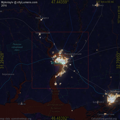
Analysis of Mykolayiv night lights 2016
Square area 10x10 km:
 14.49%
90-99
17.33%80-89
5.54%70-79
5.26%60-69
7.53%50-59
5.97%40-49
3.98%30-39
9.66%20-29
19.89%10-19
9.66%0-9
0.71%Square area 50x50 km:
0.81%90-99
1.14%80-89
0.67%70-79
0.53%60-69
0.52%50-59
0.69%40-49
0.66%30-39
0.92%20-29
1.95%10-19
4.1%0-9
88.01%Clear (daylight) street map image can be seen on geolist.org.
Map coordinates:
47° 26' 36.9" North, 31° 17' 39.4" East
46° 57' 57.3" North, 31° 59' 50.6" East
46° 29' 2.1" North, 32° 42' 1.9" East
Some cities around Mykolayiv sort by population:
• Kherson
58.5 km =36.4 mi,  126°
126°
• Ochakiv
52 km =32.3 mi,  220°
220°
• Nova Odesa
41.3 km =25.7 mi,  337°
337°
• Bashtanka
59.3 km =36.8 mi,  34°
34°
• Bilozerka
50.9 km =31.6 mi,  138°
138°
• Chornobayivka
52 km =32.3 mi, 125°
• Komyshany
53.3 km =33.1 mi, 133°
• Oleksandrivka
59.7 km =37.1 mi,  103°
103°
700569 (p: 510,840)
Sources (retrieved 2019-11-25):
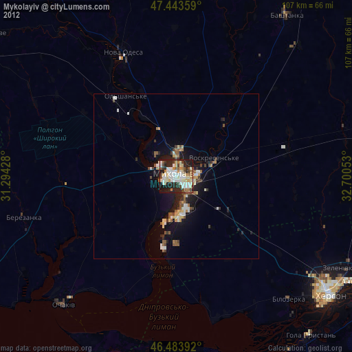
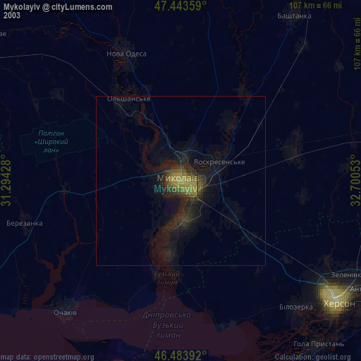
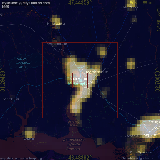
» NASA, Earths city lights 1995
» NASA city lights 2003
» Earth at Night: Flat Maps 2012, 2016