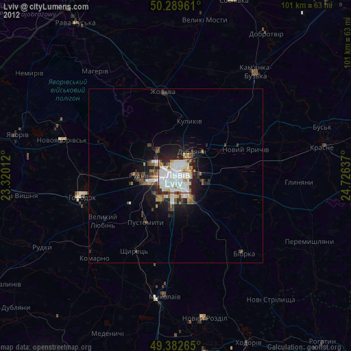
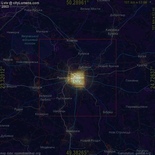
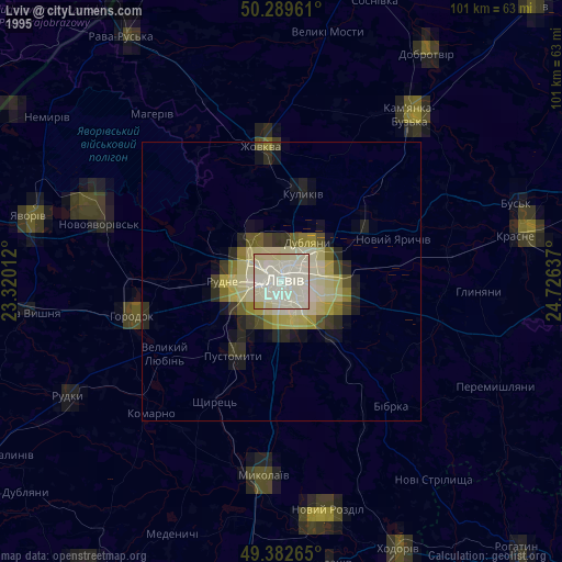
Lviv night lights from space
Night Light of Lviv from space (Ukraine) Src. Average luminocity for 10x10km area is 85.6029% and for 50x50km: 6.9516%.
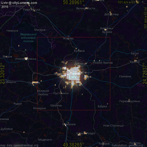
Analysis of Lviv night lights 2016
Square area 10x10 km:
 41.98%
90-99
29.81%80-89
4.68%70-79
2.81%60-69
2.54%50-59
2.14%40-49
2.81%30-39
10.43%20-29
2.81%10-19
0%0-9
0%Square area 50x50 km:
2.03%90-99
1.57%80-89
0.47%70-79
0.5%60-69
0.39%50-59
0.67%40-49
0.6%30-39
1.22%20-29
2.09%10-19
3.5%0-9
86.97%Clear (daylight) street map image can be seen on geolist.org.
Map coordinates:
50° 17' 22.6" North, 23° 19' 12.4" East
49° 50' 17.7" North, 24° 1' 23.7" East
49° 22' 57.5" North, 24° 43' 34.9" East
Some cities around Lviv sort by population:
• Horodok
27.6 km =17.1 mi,  257°
257°
• Zhovkva
24.7 km =15.3 mi,  351°
351°
• Pustomyty
15.8 km =9.8 mi,  210°
210°
• Dublyany
8.6 km =5.3 mi,  31°
31°
• Ivano-Frankove
22.9 km =14.2 mi,  293°
293°
• Rudne
8.9 km =5.5 mi,  266°
266°
• Shchyrets
23.4 km =14.5 mi, 207°
• Bryukhovychi
8.7 km =5.4 mi,  328°
328°
702550 (p: 717,803)
Sources (retrieved 2019-11-25):
» NASA, Earths city lights 1995
» NASA city lights 2003
» Earth at Night: Flat Maps 2012, 2016