Horodok night lights from space
Night Light of Horodok (Lviv) from space (Ukraine) Src. Average luminocity for 10x10km area is 4.7072% and for 50x50km: 2.9924%.
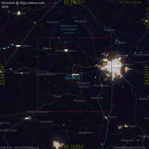
Analysis of Horodok night lights 2016
Square area 10x10 km:
 0.53%
0.53%90-99
0%80-89
0.8%70-79
1.47%60-69
2.01%50-59
0.53%40-49
0%30-39
0%20-29
0%10-19
0%0-9
94.65%Square area 50x50 km:
0.61%90-99
0.62%80-89
0.22%70-79
0.26%60-69
0.26%50-59
0.39%40-49
0.35%30-39
0.68%20-29
0.88%10-19
1.55%0-9
94.17%Clear (daylight) street map image can be seen on geolist.org.
Map coordinates:
50° 14' 11.4" North, 22° 56' 41.8" East
49° 47' 4.7" North, 23° 38' 53" East
49° 19' 42.7" North, 24° 21' 4.3" East
Some cities around Horodok sort by population:
• Novoyavorivs'k
17 km =10.6 mi,  341°
341°
• Yavoriv
25.6 km =15.9 mi,  311°
311°
• Pustomyty
20.5 km =12.7 mi,  112°
112°
• Sudova Vyshnya
19.8 km =12.3 mi,  271°
271°
• Ivano-Frankove
16.1 km =10 mi,  21°
21°
• Rudne
18.9 km =11.7 mi,  73°
73°
• Shchyrets
22 km =13.7 mi,  132°
132°
• Shklo
20.5 km =12.7 mi, 338°
708313 (p: 15,993)
Sources (retrieved 2019-11-25):
» Earth at Night: Flat Maps 2012, 2016