Kerch night lights from space
Night Light of Kerch (Crimea) from space (Ukraine) Src. Average luminocity for 10x10km area is 36.846% and for 50x50km: 3.635%.
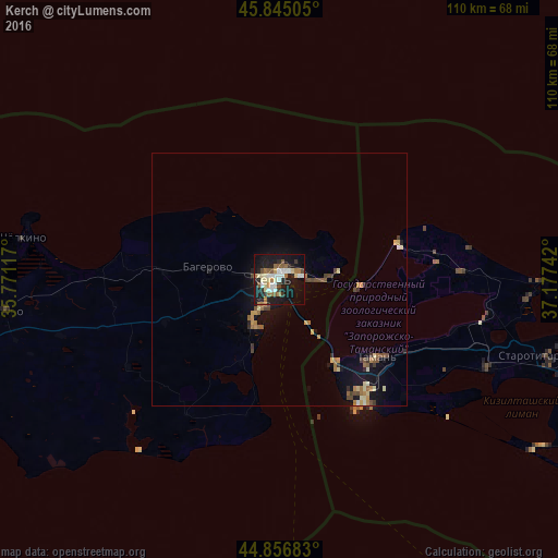
Analysis of Kerch night lights 2016
Square area 10x10 km:
 6.19%
6.19%90-99
7.14%80-89
5.08%70-79
1.75%60-69
6.67%50-59
5.4%40-49
2.22%30-39
3.49%20-29
7.78%10-19
40.79%0-9
13.49%Square area 50x50 km:
0.27%90-99
0.42%80-89
0.52%70-79
0.39%60-69
0.69%50-59
0.52%40-49
0.61%30-39
0.44%20-29
0.49%10-19
3.43%0-9
92.23%Clear (daylight) street map image can be seen on geolist.org.
Map coordinates:
45° 50' 42.2" North, 35° 46' 16.2" East
45° 21' 24.3" North, 36° 28' 31.5" East
44° 51' 24.6" North, 37° 10' 38.7" East
Some cities around Kerch sort by population:
• Temryuk, RU
71.9 km =44.7 mi,  97°
97°
• Primorskiy
82.7 km =51.4 mi,  250°
250°
• Starotitarovskaya, RU
55.3 km =34.4 mi,  106°
106°
• Shchyolkino
51.6 km =32.1 mi,  279°
279°
• Taman’, RU
24.8 km =15.4 mi,  130°
130°
• Lenino
55 km =34.2 mi,  263°
263°
• Vityazevo, RU
74.6 km =46.4 mi,  122°
122°
• Strelka, RU
65.6 km =40.8 mi, 104°
706524 (p: 148,932)
Sources (retrieved 2019-11-25):
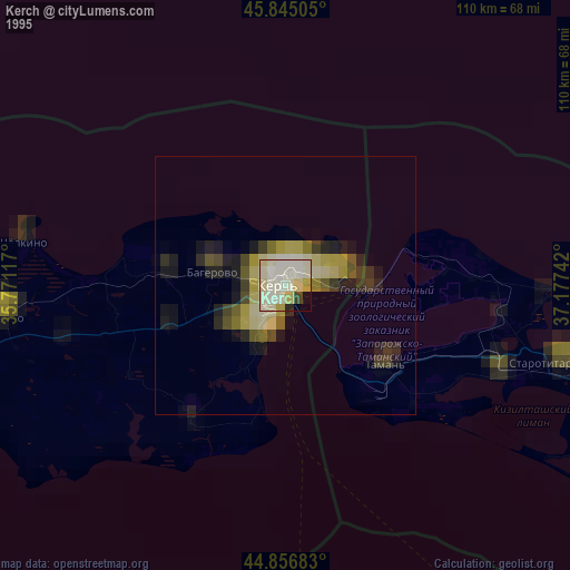
» NASA, Earths city lights 1995
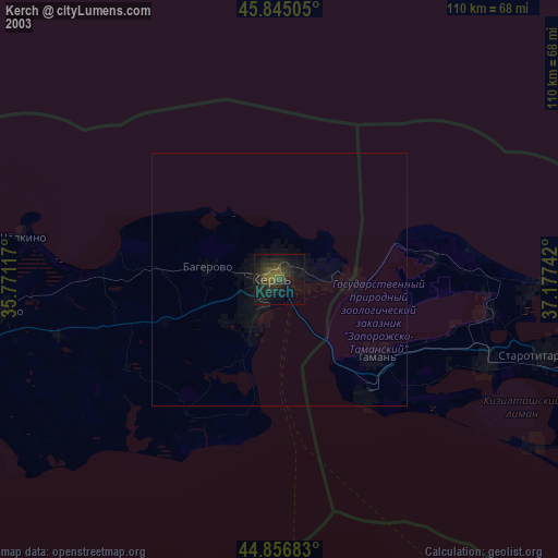
» NASA city lights 2003
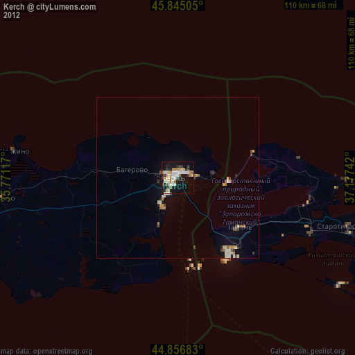
» Earth at Night: Flat Maps 2012, 2016