Taman’ night lights from space
Night Light of Taman’ (Krasnodarskiy) from space (Russia) Src. Average luminocity for 10x10km area is 10.5864% and for 50x50km: 3.9831%.
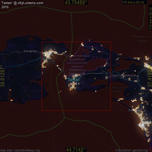
Analysis of Taman’ night lights 2016
Square area 10x10 km:
 0%
0%90-99
1.21%80-89
1.21%70-79
0%60-69
1.36%50-59
2.12%40-49
2.73%30-39
2.27%20-29
0.61%10-19
17.88%0-9
70.61%Square area 50x50 km:
0.26%90-99
0.44%80-89
0.54%70-79
0.41%60-69
0.78%50-59
0.55%40-49
0.82%30-39
0.52%20-29
0.63%10-19
3.58%0-9
91.46%Clear (daylight) street map image can be seen on geolist.org.
Map coordinates:
45° 42' 17.6" North, 36° 0' 46.7" East
45° 12' 42.1" North, 36° 42' 57.9" East
44° 42' 51.1" North, 37° 25' 9.2" East
Some cities around Taman’ sort by population:
• Kerch, UA
24.8 km =15.4 mi,  310°
310°
• Anapa
58.8 km =36.5 mi,  126°
126°
• Temryuk
52.9 km =32.9 mi,  82°
82°
• Anapskaya
63.2 km =39.3 mi,  123°
123°
• Starotitarovskaya
34.4 km =21.4 mi,  88°
88°
• Gostagayevskaya
65.4 km =40.6 mi,  108°
108°
• Vityazevo
50.2 km =31.2 mi, 117°
• Strelka
44.7 km =27.8 mi, 90°
484670 (p: 9,417)
Sources (retrieved 2019-11-25):
» Earth at Night: Flat Maps 2012, 2016