Donetsk night lights from space
Night Light of Donetsk from space (Ukraine) Src. Average luminocity for 10x10km area is 68.277% and for 50x50km: 10.6191%.
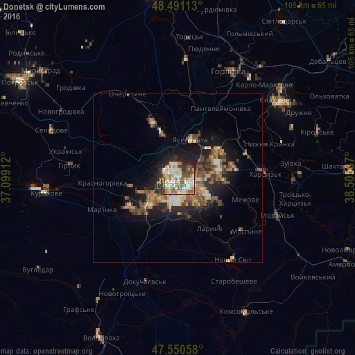
Analysis of Donetsk night lights 2016
Square area 10x10 km:
 13.64%
90-99
20.6%80-89
8.1%70-79
6.96%60-69
11.36%50-59
15.48%40-49
5.82%30-39
5.26%20-29
10.23%10-19
2.56%0-9
0%Square area 50x50 km:
0.88%90-99
1.74%80-89
0.99%70-79
1.46%60-69
1.69%50-59
2.55%40-49
2%30-39
1.5%20-29
3.04%10-19
6.45%0-9
77.69%Clear (daylight) street map image can be seen on geolist.org.
Map coordinates:
48° 29' 28.1" North, 37° 5' 56.8" East
48° 1' 22.8" North, 37° 48' 8.1" East
47° 33' 2.1" North, 38° 30' 19.3" East
Some cities around Donetsk sort by population:
• Makiyivka
9.6 km =6 mi,  73°
73°
• Khartsyz’k
25.7 km =16 mi,  85°
85°
• Yasynuvata
12.6 km =7.8 mi,  19°
19°
• Avdiyivka
13.7 km =8.5 mi,  341°
341°
• Nyzhnya Krynka
28.5 km =17.7 mi, 69°
• Mospyne
24.4 km =15.2 mi,  127°
127°
• Mar'yinka
23.7 km =14.7 mi,  248°
248°
• Novyy Svit
29.1 km =18.1 mi,  145°
145°
709717 (p: 1,024,700)
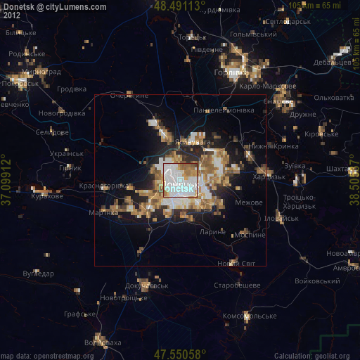
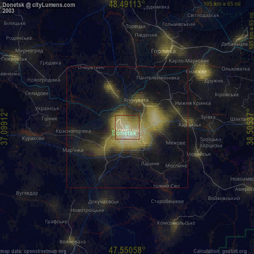
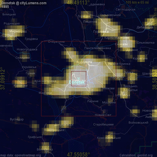
Sources (retrieved 2019-11-25):
» NASA, Earths city lights 1995
» NASA city lights 2003
» Earth at Night: Flat Maps 2012, 2016