Majengo night lights from space
Night Light of Majengo (Tanga) from space (Tanzania) Src. Average luminocity for 10x10km area is 6.2727% and for 50x50km: 2.485%.
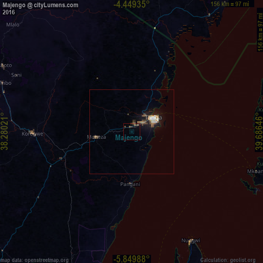
Analysis of Majengo night lights 2016
Square area 10x10 km:
100  0%
0%
90-99 0.62%
80-89 0.83%
70-79 0.21%
60-69 0.83%
50-59 1.65%
40-49 3.51%
30-39 1.24%
20-29 0.21%
10-19 2.07%
0-9 88.84%
0%90-99
0.62%80-89
0.83%70-79
0.21%60-69
0.83%50-59
1.65%40-49
3.51%30-39
1.24%20-29
0.21%10-19
2.07%0-9
88.84%Square area 50x50 km:
100 0.12%
90-99 0.5%
80-89 0.14%
70-79 0.27%
60-69 0.33%
50-59 0.29%
40-49 0.77%
30-39 0.4%
20-29 0.26%
10-19 2.41%
0-9 94.51%
0.12%90-99
0.5%80-89
0.14%70-79
0.27%60-69
0.33%50-59
0.29%40-49
0.77%30-39
0.4%20-29
0.26%10-19
2.41%0-9
94.51%Clear (daylight) street map image can be seen on geolist.org.
Map coordinates:
4° 26' 57.7" South, 38° 16' 48.8" East
5° 9' 0" South, 38° 58' 60" East
5° 50' 59.6" South, 39° 41' 11.3" East
Some cities around Majengo sort by population:
• Tanga
15.6 km =9.7 mi,  54°
54°
• Maramba
42.1 km =26.2 mi,  285°
285°
• Wete
83.3 km =51.8 mi,  82°
82°
• Muheza
22.2 km =13.8 mi,  265°
265°
• Mlalo
24.7 km =15.3 mi,  347°
347°
• Soni
76 km =47.2 mi,  296°
296°
• Pangani
30.6 km =19 mi,  181°
181°
• Nungwi
73 km =45.4 mi,  151°
151°
155244 (p: 9,874)
Sources (retrieved 2019-11-25):
» Earth at Night: Flat Maps 2012, 2016