Vezirköprü night lights from space
Night Light of Vezirköprü (Samsun) from space (Turkey) Src. Average luminocity for 10x10km area is 18.4107% and for 50x50km: 2.4759%.
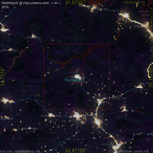
Analysis of Vezirköprü night lights 2016
Square area 10x10 km:
 1.62%
1.62%90-99
6.17%80-89
2.6%70-79
0.65%60-69
0.65%50-59
0.16%40-49
3.9%30-39
2.27%20-29
0.16%10-19
16.4%0-9
65.42%Square area 50x50 km:
0.14%90-99
0.42%80-89
0.26%70-79
0.19%60-69
0.33%50-59
0.19%40-49
0.59%30-39
0.42%20-29
0.25%10-19
2.19%0-9
95.02%Clear (daylight) street map image can be seen on geolist.org.
Map coordinates:
41° 40' 15.5" North, 34° 45' 5.8" East
41° 8' 37" North, 35° 27' 17" East
40° 36' 43.1" North, 36° 9' 28.3" East
Some cities around Vezirköprü sort by population:
• Merzifon
30.1 km =18.7 mi,  178°
178°
• Suluova
38.3 km =23.8 mi,  154°
154°
• Havza
25.9 km =16.1 mi,  137°
137°
• Gümüşhacıköy
36.2 km =22.5 mi,  213°
213°
• Durağan
45.1 km =28 mi,  312°
312°
• Ladik
44.9 km =27.9 mi,  125°
125°
• Kavak
49.8 km =30.9 mi,  98°
98°
• Yakakent
54.7 km =34 mi,  6°
6°
738167 (p: 25,155)
Sources (retrieved 2019-11-25):
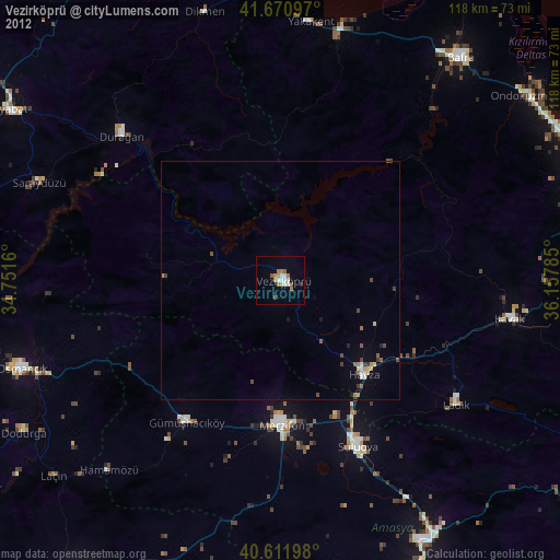
» Earth at Night: Flat Maps 2012, 2016