Savur night lights from space
Night Light of Savur (Mardin) from space (Turkey) Src. Average luminocity for 10x10km area is 7.0081% and for 50x50km: 4.1656%.
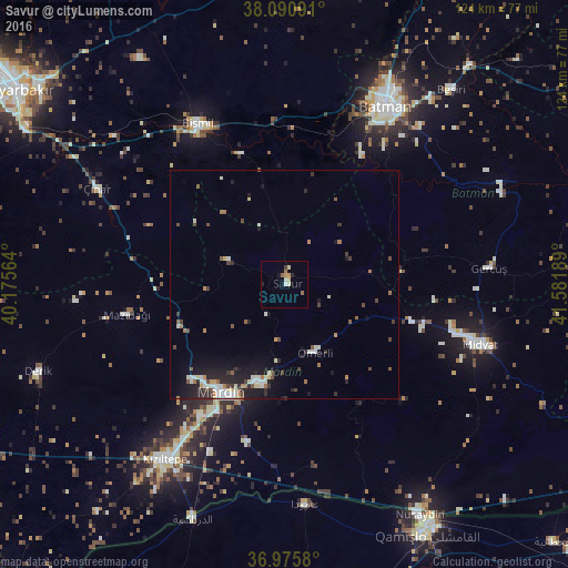
Analysis of Savur night lights 2016
Square area 10x10 km:
 0%
0%90-99
1.62%80-89
1.62%70-79
1.3%60-69
1.3%50-59
0.65%40-49
0%30-39
0.65%20-29
1.14%10-19
0.81%0-9
90.91%Square area 50x50 km:
0.46%90-99
0.92%80-89
0.45%70-79
0.27%60-69
0.5%50-59
0.58%40-49
0.55%30-39
0.58%20-29
1.04%10-19
2.78%0-9
91.87%Clear (daylight) street map image can be seen on geolist.org.
Map coordinates:
38° 5' 27.3" North, 40° 10' 32.3" East
37° 32' 7.6" North, 40° 52' 43.5" East
36° 58' 32.9" North, 41° 34' 54.8" East
Some cities around Savur sort by population:
• Mardin
27.5 km =17.1 mi,  205°
205°
• Yeşilli
22.6 km =14 mi,  193°
193°
• Kabala
22.2 km =13.8 mi,  198°
198°
• Ebish
28.5 km =17.7 mi,  106°
106°
• Çavuşlu
32.8 km =20.4 mi,  96°
96°
• Kindirip
31.6 km =19.6 mi, 108°
• Ömerli
16.6 km =10.3 mi,  156°
156°
• Kayapınar
25.1 km =15.6 mi,  84°
84°
301431 (p: 8,658)
Sources (retrieved 2019-11-25):
» Earth at Night: Flat Maps 2012, 2016