Fethiye night lights from space
Night Light of Fethiye (Muğla) from space (Turkey) Src. Average luminocity for 10x10km area is 64.0293% and for 50x50km: 10.0591%.
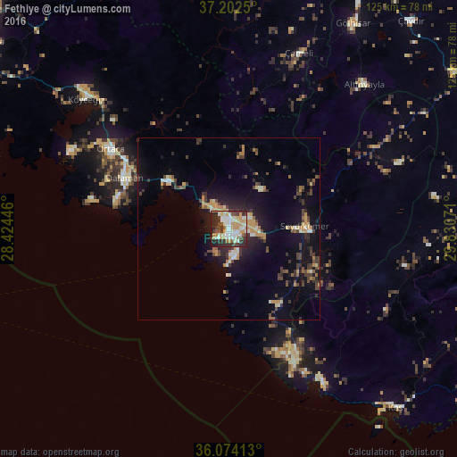
Analysis of Fethiye night lights 2016
Square area 10x10 km:
 12.27%
90-99
18.5%80-89
7.51%70-79
15.75%60-69
2.56%50-59
4.4%40-49
6.96%30-39
11.54%20-29
17.58%10-19
2.93%0-9
0%Square area 50x50 km:
0.63%90-99
1.49%80-89
0.97%70-79
2.2%60-69
0.79%50-59
0.79%40-49
1.99%30-39
2.33%20-29
2.75%10-19
6.87%0-9
79.19%Clear (daylight) street map image can be seen on geolist.org.
Map coordinates:
37° 12' 9" North, 28° 25' 28.1" East
36° 38' 25.4" North, 29° 7' 39.3" East
36° 4' 26.9" North, 29° 49' 50.6" East
Some cities around Fethiye sort by population:
• Marmaris
79.7 km =49.5 mi,  287°
287°
• Ortaca
39.2 km =24.4 mi,  304°
304°
• Dalaman
32.1 km =19.9 mi, 295°
• Elmalı
71.2 km =44.2 mi,  81°
81°
• Sarigerme
38.7 km =24 mi,  282°
282°
• Gölhisar
65.6 km =40.8 mi,  31°
31°
• Kaş
66.8 km =41.5 mi,  136°
136°
• Ula
81.6 km =50.7 mi,  309°
309°
314967 (p: 60,437)
Sources (retrieved 2019-11-25):
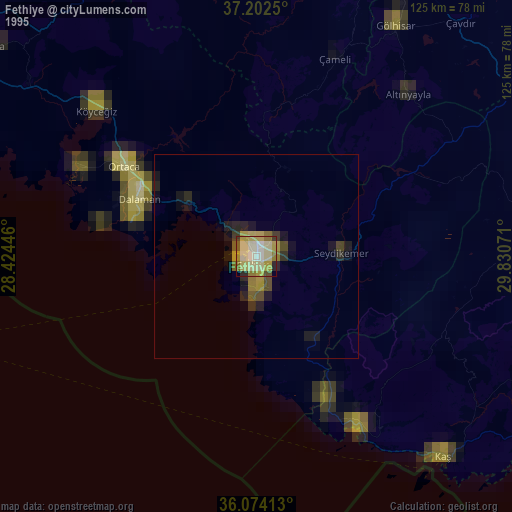
» NASA, Earths city lights 1995
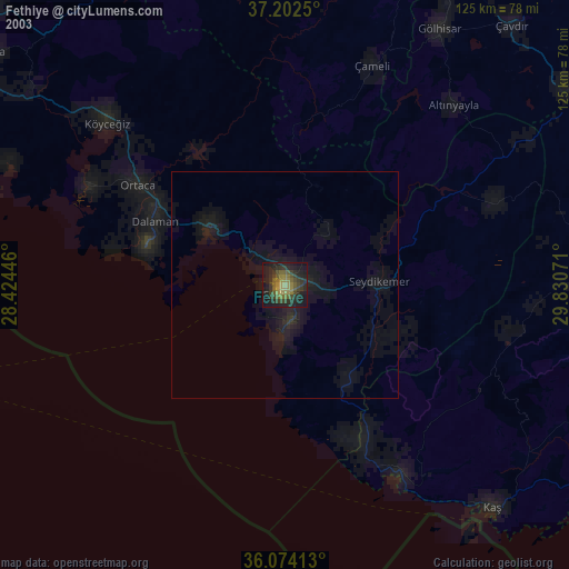
» NASA city lights 2003
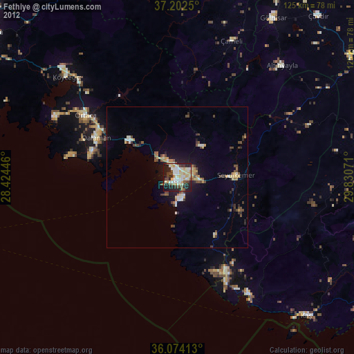
» Earth at Night: Flat Maps 2012, 2016