Kadirli night lights from space
Night Light of Kadirli (Osmaniye) from space (Turkey) Src. Average luminocity for 10x10km area is 39.8442% and for 50x50km: 6.3809%.
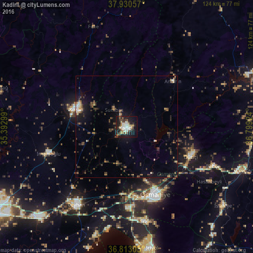
Analysis of Kadirli night lights 2016
Square area 10x10 km:
 4.71%
4.71%90-99
11.53%80-89
5.52%70-79
4.55%60-69
1.79%50-59
3.41%40-49
6.01%30-39
6.01%20-29
11.04%10-19
33.77%0-9
11.69%Square area 50x50 km:
0.35%90-99
0.86%80-89
0.65%70-79
0.54%60-69
0.51%50-59
0.91%40-49
1.54%30-39
1.78%20-29
1.83%10-19
4.87%0-9
86.15%Clear (daylight) street map image can be seen on geolist.org.
Map coordinates:
37° 55' 50.1" North, 35° 23' 34.8" East
37° 22' 26" North, 36° 5' 46" East
36° 48' 47" North, 36° 47' 57.3" East
Some cities around Kadirli sort by population:
• Osmaniye
35.9 km =22.3 mi,  158°
158°
• Ceyhan
46 km =28.6 mi,  212°
212°
• Kozan
26.4 km =16.4 mi,  290°
290°
• İmamoğlu
40.7 km =25.3 mi,  252°
252°
• Erzin
47.6 km =29.6 mi,  169°
169°
• Bahçe
46.8 km =29.1 mi,  114°
114°
• Andırın
32.2 km =20 mi,  45°
45°
• Toprakkale
34.2 km =21.3 mi, 172°
310892 (p: 70,248)
Sources (retrieved 2019-11-25):
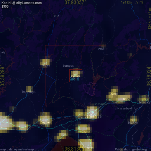
» NASA, Earths city lights 1995
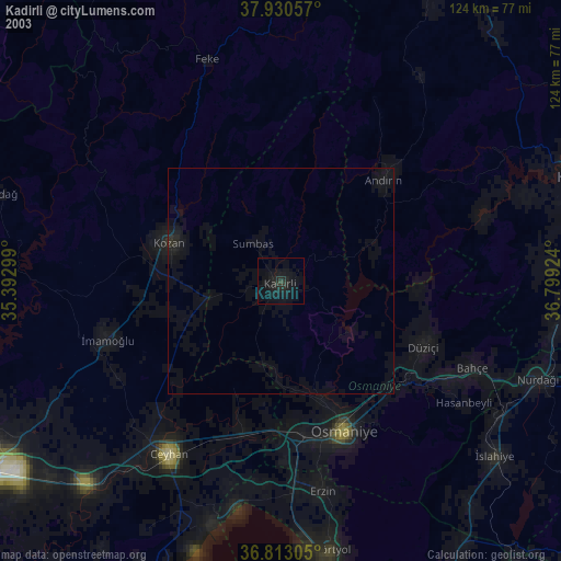
» NASA city lights 2003
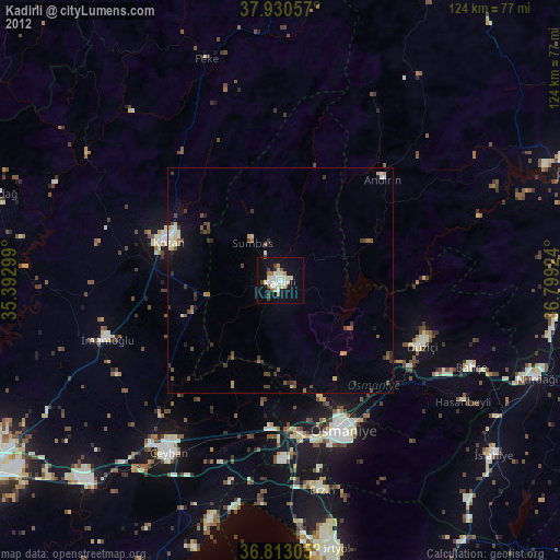
» Earth at Night: Flat Maps 2012, 2016