Dargeçit night lights from space
Night Light of Dargeçit (Mardin) from space (Turkey) Src. Average luminocity for 10x10km area is 9.836% and for 50x50km: 3.4405%.
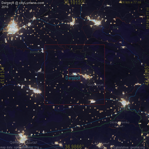

Analysis of Dargeçit night lights 2016
Square area 10x10 km:
 1.46%
1.46%90-99
1.79%80-89
0.65%70-79
0%60-69
2.27%50-59
0%40-49
1.46%30-39
0.81%20-29
1.95%10-19
1.79%0-9
87.82%Square area 50x50 km:
0.18%90-99
0.57%80-89
0.31%70-79
0.29%60-69
0.54%50-59
0.29%40-49
0.82%30-39
0.82%20-29
0.58%10-19
2%0-9
93.61%Clear (daylight) street map image can be seen on geolist.org.
Map coordinates:
38° 6' 5.6" North, 41° 0' 48.2" East
37° 32' 46.2" North, 41° 42' 59.5" East
36° 59' 11.8" North, 42° 25' 10.7" East
Some cities around Dargeçit sort by population:
• Midyat
36.2 km =22.5 mi,  247°
247°
• Kurtalan
42.3 km =26.3 mi,  356°
356°
• İdil
28 km =17.4 mi,  146°
146°
• Gerdzhyush
29.9 km =18.6 mi,  273°
273°
• Çavuşlu
41.5 km =25.8 mi,  263°
263°
• Acırlı
38.5 km =23.9 mi, 254°
• Gelinkaya
41.9 km =26 mi, 249°
• Yolbaşı
39.4 km =24.5 mi,  243°
243°
317587 (p: 20,793)
Sources (retrieved 2019-11-25):
» Earth at Night: Flat Maps 2012, 2016