Çifteler night lights from space
Night Light of Çifteler (Eskişehir) from space (Turkey) Src. Average luminocity for 10x10km area is 12.4796% and for 50x50km: 1.8937%.
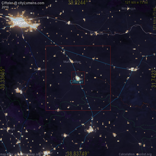
Analysis of Çifteler night lights 2016
Square area 10x10 km:
 1.53%
1.53%90-99
2.38%80-89
3.74%70-79
0.85%60-69
0.34%50-59
0.68%40-49
1.36%30-39
0%20-29
1.87%10-19
2.55%0-9
84.69%Square area 50x50 km:
0.06%90-99
0.2%80-89
0.36%70-79
0.19%60-69
0.19%50-59
0.37%40-49
0.43%30-39
0.51%20-29
0.55%10-19
0.34%0-9
96.79%Clear (daylight) street map image can be seen on geolist.org.
Map coordinates:
39° 55' 27.8" North, 30° 20' 9.8" East
39° 22' 59" North, 31° 2' 21" East
38° 50' 15" North, 31° 44' 32.3" East
Some cities around Çifteler sort by population:
• Eskişehir
62.4 km =38.8 mi,  314°
314°
• Bolvadin
74.7 km =46.4 mi,  179°
179°
• Emirdağ
41.5 km =25.8 mi,  166°
166°
• İscehisar
63.1 km =39.2 mi,  203°
203°
• Sivrihisar
43.2 km =26.8 mi,  80°
80°
• Alpu
43.4 km =27 mi,  351°
351°
• İhsaniye
66.5 km =41.3 mi,  233°
233°
• Beylikova
36.7 km =22.8 mi,  22°
22°
318603 (p: 10,166)
Sources (retrieved 2019-11-25):
» Earth at Night: Flat Maps 2012, 2016